Stanisławów geodata
Stanisławów (Mazovia) is a seat of a third-order administrative division; located in Poland in Europe/Warsaw (GMT+2) time zone. With population of 2,200 people, there are 1362 cities with bigger population in this country. Compared to other cities in Poland, 72.2% of cities are located further ↓South; 79.6% of cities are located further ←West and 59.9% of cities have higher elevation than Stanisławów. Note1


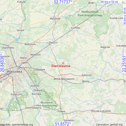
Stanisławów GPS coordinates[2]
52° 17' 21.732" North, 21° 32' 54.528" East
| Map corner | latitude | longitude |
|---|---|---|
| Upper-left | 52.71737°, | 20.84536° |
| Center: | 52.28937°, | 21.54848° |
| Lower-right: | 51.8572°, | 22.25161° |
| Map W x H: | 95.6×95.6 km | = 59.4×59.4mi |
| max Lat: | 54.83135° ⇑27.8% North |
| Stanisławów: | 52.28937° |
| min Lat: | ⇓72.2% South 49.21328° |
| min Long | Stanisławów | max Long |
| 14.20249° | 21.54848° | 24.03723° |
| W 79.6%⇐ | ⇒20.4% E |
Elevation
Elevation of Stanisławów is 147 m = 482 ft, and this is 44.4 m = 146 ft below average elevation for this country.
| Max E: |
974 m = 3196 ft | 59.9% |
| Avg. | 191.4 m = 628 ft | |
| Stanisławów | 147 m = 482 ft | |
Min E: |
-3 m = -10 ft | 40.1% |
See also: Poland elevation on elevation.city.
Geographical zone
Stanisławów is located in North temperate zone (between Tropic of Cancer and the Arctic Circle). Distance of this North polar circle is 1587.1 km =986.2 mi to North.| Distance of | km | miles | from Stanisławów |
|---|---|---|---|
| North Pole | 4193 | 2605.4 | to North |
| Arctic Circle | 1587.1 | 986.2 | to North |
| Tropic Cancer | 3208.1 | 1993.4 | to South |
| Equator | 5814 | 3612.7 | to South |


Nearby cities:
15 places around Stanisławów: (largest is in red/bold)
• Dobre
9.5 km =5.9 mi,  68°
68°
• Duczki
19.3 km =12 mi,  294°
294°
• Dębe Wielkie
12.3 km =7.6 mi,  215°
215°
• Halinów
14.8 km =9.2 mi,  242°
242°
• Jakubów
11.9 km =7.4 mi,  130°
130°
• Jasienica
16.7 km =10.4 mi,  326°
326°
• Mińsk Mazowiecki
12.3 km =7.6 mi,  172°
172°
• Ostrówek
16.6 km =10.3 mi,  312°
312°
• Pogorzel
19.7 km =12.2 mi, 172°
• Poświętne
9.7 km =6 mi,  297°
297°
• Stare Grabie
18 km =11.2 mi, 299°
• Strachówka
16.4 km =10.2 mi,  21°
21°
• Sulejówek
19.5 km =12.1 mi,  257°
257°
• Tłuszcz
17.5 km =10.9 mi, 333°
• Wiśniew
12.5 km =7.8 mi,  106°
106°
Sources, notices
• [Note1] Compared only with cities in Poland existing in our database
• [Src1] Map data: © OpenStreetMap contributors (CC-BY-SA)
• [Src2] Other city data from geonames.org with taken over terms of usage.
• [Src3] Geographical zone / Annual Mean Temperature by Robert A. Rohde @ Wikipedia
