Wiśniew geodata
Wiśniew (Mazovia) is a populated place; located in Poland in Europe/Warsaw (GMT+2) time zone. With population of 505 people, there are 3528 cities with bigger population in this country. Compared to other cities in Poland, 71.7% of cities are located further ↓South; 81.4% of cities are located further ←West and 60% of cities have lower elevation than Wiśniew. Note1


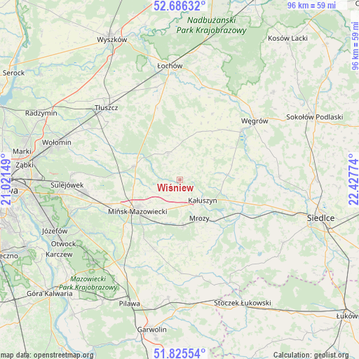
Wiśniew GPS coordinates[2]
52° 15' 28.872" North, 21° 43' 28.596" East
| Map corner | latitude | longitude |
|---|---|---|
| Upper-left | 52.68632°, | 21.02149° |
| Center: | 52.25802°, | 21.72461° |
| Lower-right: | 51.82554°, | 22.42774° |
| Map W x H: | 95.7×95.7 km | = 59.5×59.5mi |
| max Lat: | 54.83135° ⇑28.3% North |
| Wiśniew: | 52.25802° |
| min Lat: | ⇓71.7% South 49.21328° |
| min Long | Wiśniew | max Long |
| 14.20249° | 21.72461° | 24.03723° |
| W 81.4%⇐ | ⇒18.6% E |
Elevation
Elevation of Wiśniew is 200 m = 656 ft, and this is 8.6 m = 28 ft above average elevation for this country.
| Max E: |
974 m = 3196 ft | 40% |
| Wiśniew | 200 m 656 ft | |
| Avg. | 191.4 m = 628 ft | |
Min E: |
-3 m = -10 ft | 60% |
See also: Poland elevation on elevation.city.
Geographical zone
Wiśniew is located in North temperate zone (between Tropic of Cancer and the Arctic Circle). Distance of this North polar circle is 1590.6 km =988.4 mi to North.| Distance of | km | miles | from Wiśniew |
|---|---|---|---|
| North Pole | 4196.5 | 2607.6 | to North |
| Arctic Circle | 1590.6 | 988.4 | to North |
| Tropic Cancer | 3204.6 | 1991.2 | to South |
| Equator | 5810.5 | 3610.5 | to South |


Nearby cities:
15 places around Wiśniew: (largest is in red/bold)
• Cegłów
12.3 km =7.6 mi,  175°
175°
• Dobre
7.7 km =4.8 mi,  336°
336°
• Dębe Wielkie
20.2 km =12.6 mi,  251°
251°
• Grębków
12.7 km =7.9 mi,  84°
84°
• Jakubów
5.2 km =3.2 mi,  215°
215°
• Kałuszyn
8.1 km =5 mi,  135°
135°
• Korytnica
19.3 km =12 mi,  26°
26°
• Liw
21 km =13 mi,  51°
51°
• Mińsk Mazowiecki
13.6 km =8.5 mi,  229°
229°
• Mrozy
11.5 km =7.1 mi,  152°
152°
• Pogorzel
18.5 km =11.5 mi,  210°
210°
• Siennica
19.8 km =12.3 mi,  201°
201°
• Stanisławów
12.5 km =7.8 mi,  286°
286°
• Strachówka
19.7 km =12.2 mi, 342°
• Wierzbno
10.8 km =6.7 mi,  57°
57°
Sources, notices
• [Note1] Compared only with cities in Poland existing in our database
• [Src1] Map data: © OpenStreetMap contributors (CC-BY-SA)
• [Src2] Other city data from geonames.org with taken over terms of usage.
• [Src3] Geographical zone / Annual Mean Temperature by Robert A. Rohde @ Wikipedia
