Słotowa geodata
Słotowa (Subcarpathian) is a populated place; located in Poland in Europe/Warsaw (GMT+2) time zone. With population of 1,087 people, there are 2374 cities with bigger population in this country. Compared to other cities in Poland, 85.7% of cities are located further ↑North; 76.9% of cities are located further ←West and 69.1% of cities have lower elevation than Słotowa. Note1


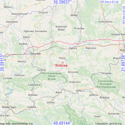
Słotowa GPS coordinates[2]
49° 56' 45.708" North, 21° 17' 39.3" East
| Map corner | latitude | longitude |
|---|---|---|
| Upper-left | 50.39637°, | 20.59113° |
| Center: | 49.94603°, | 21.29425° |
| Lower-right: | 49.49144°, | 21.99738° |
| Map W x H: | 100.6×100.6 km | = 62.5×62.5mi |
| max Lat: | 54.83135° ⇑85.7% North |
| Słotowa: | 49.94603° |
| min Lat: | ⇓14.3% South 49.21328° |
| min Long | Słotowa | max Long |
| 14.20249° | 21.29425° | 24.03723° |
| W 76.9%⇐ | ⇒23.1% E |
Elevation
Elevation of Słotowa is 226 m = 741 ft, and this is 34.6 m = 114 ft above average elevation for this country.
| Max E: |
974 m = 3196 ft | 30.9% |
| Słotowa | 226 m 741 ft | |
| Avg. | 191.4 m = 628 ft | |
Min E: |
-3 m = -10 ft | 69.1% |
See also: Poland elevation on elevation.city.
Geographical zone
Słotowa is located in North temperate zone (between Tropic of Cancer and the Arctic Circle). Distance of this North polar circle is 1847.7 km =1148.1 mi to North.| Distance of | km | miles | from Słotowa |
|---|---|---|---|
| North Pole | 4453.6 | 2767.3 | to North |
| Arctic Circle | 1847.7 | 1148.1 | to North |
| Tropic Cancer | 2947.6 | 1831.6 | to South |
| Equator | 5553.5 | 3450.8 | to South |


Nearby cities:
15 places around Słotowa: (largest is in red/bold)
• Brzostek
11.2 km =7 mi,  131°
131°
• Brzyska
15.4 km =9.6 mi,  153°
153°
• Czarna
13.7 km =8.5 mi,  348°
348°
• Dębica
14.4 km =8.9 mi,  35°
35°
• Jodłowa
8.3 km =5.2 mi,  187°
187°
• Karwodrza
15.9 km =9.9 mi,  262°
262°
• Pilzno
3.6 km =2.2 mi,  357°
357°
• Pogórska Wola
12.6 km =7.8 mi,  309°
309°
• Przyborów
9.7 km =6 mi,  19°
19°
• Ryglice
13.5 km =8.4 mi,  236°
236°
• Strzegocice
2.1 km =1.3 mi,  73°
73°
• Szerzyny
15.6 km =9.7 mi, 192°
• Szynwałd
12.5 km =7.8 mi,  281°
281°
• Łęki Dolne
4.6 km =2.9 mi, 312°
• Łęki Górne
9.1 km =5.7 mi,  289°
289°
Sources, notices
• [Note1] Compared only with cities in Poland existing in our database
• [Src1] Map data: © OpenStreetMap contributors (CC-BY-SA)
• [Src2] Other city data from geonames.org with taken over terms of usage.
• [Src3] Geographical zone / Annual Mean Temperature by Robert A. Rohde @ Wikipedia
