Pogórska Wola geodata
Pogórska Wola (Lesser Poland) is a populated place; located in Poland in Europe/Warsaw (GMT+2) time zone. With population of 2,707 people, there are 1158 cities with bigger population in this country. Compared to other cities in Poland, 81.4% of cities are located further ↑North; 75.2% of cities are located further ←West and 69.8% of cities have lower elevation than Pogórska Wola. Note1


Pogórska Wola GPS coordinates[2]
50° 1' 6.78" North, 21° 9' 28.62" East
| Map corner | latitude | longitude |
|---|---|---|
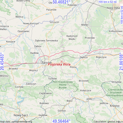
| Upper-left | 50.46821°, | 20.45483° |
| Center: | 50.01855°, | 21.15795° |
| Lower-right: | 49.56464°, | 21.86108° |
| Map W x H: | 100.5×100.5 km | = 62.4×62.4mi |
| max Lat: | 54.83135° ⇑81.4% North |
| Pogórska Wola: | 50.01855° |
| min Lat: | ⇓18.6% South 49.21328° |
| min Long | Pogórska Wola | max Long |
| 14.20249° | 21.15795° | 24.03723° |
| W 75.2%⇐ | ⇒24.8% E |
Elevation
Elevation of Pogórska Wola is 229 m = 751 ft, and this is 37.6 m = 123 ft above average elevation for this country.
| Max E: |
974 m = 3196 ft | 30.2% |
| Pogórska Wola | 229 m 751 ft | |
| Avg. | 191.4 m = 628 ft | |
Min E: |
-3 m = -10 ft | 69.8% |
See also: Poland elevation on elevation.city.
Geographical zone
Pogórska Wola is located in North temperate zone (between Tropic of Cancer and the Arctic Circle). Distance of this North polar circle is 1839.6 km =1143.1 mi to North.| Distance of | km | miles | from Pogórska Wola |
|---|---|---|---|
| North Pole | 4445.5 | 2762.3 | to North |
| Arctic Circle | 1839.6 | 1143.1 | to North |
| Tropic Cancer | 2955.6 | 1836.5 | to South |
| Equator | 5561.5 | 3455.8 | to South |


Nearby cities:
15 places around Pogórska Wola: (largest is in red/bold)
• Czarna
8.9 km =5.5 mi,  52°
52°
• Jodłówka-Wałki
3.9 km =2.4 mi,  333°
333°
• Karwodrza
11.9 km =7.4 mi,  210°
210°
• Lisia Góra
10.7 km =6.6 mi,  310°
310°
• Pilzno
10.6 km =6.6 mi,  114°
114°
• Przyborów
13.1 km =8.1 mi,  85°
85°
• Skrzyszów
7.4 km =4.6 mi,  248°
248°
• Smyków
14.1 km =8.8 mi,  350°
350°
• Strzegocice
13.9 km =8.6 mi,  122°
122°
• Szynwałd
6.2 km =3.9 mi,  203°
203°
• Słotowa
12.6 km =7.8 mi,  129°
129°
• Tarnowiec
12.9 km =8 mi, 251°
• Tarnów
12.2 km =7.6 mi,  267°
267°
• Łęki Dolne
8.1 km =5 mi, 127°
• Łęki Górne
5.1 km =3.2 mi,  166°
166°
Sources, notices
• [Note1] Compared only with cities in Poland existing in our database
• [Src1] Map data: © OpenStreetMap contributors (CC-BY-SA)
• [Src2] Other city data from geonames.org with taken over terms of usage.
• [Src3] Geographical zone / Annual Mean Temperature by Robert A. Rohde @ Wikipedia
