Małogoszcz geodata
Małogoszcz (Świętokrzyskie) is a seat of a third-order administrative division; located in Poland in Europe/Warsaw (GMT+2) time zone. With population of 3,890 people, there are 839 cities with bigger population in this country. Compared to other cities in Poland, 59.9% of cities are located further ↑North; 62% of cities are located further ←West and 84.2% of cities have lower elevation than Małogoszcz. Note1
Administrative division(s):
- Level 1: Świętokrzyskie
- Level 2: Powiat jędrzejowski
- Level 3: Małogoszcz


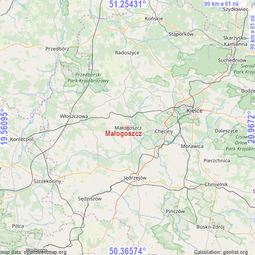
Małogoszcz GPS coordinates[2]
50° 48' 43.704" North, 20° 15' 50.652" East
| Map corner | latitude | longitude |
|---|---|---|
| Upper-left | 51.25431°, | 19.56095° |
| Center: | 50.81214°, | 20.26407° |
| Lower-right: | 50.36574°, | 20.9672° |
| Map W x H: | 98.8×98.8 km | = 61.4×61.4mi |
| max Lat: | 54.83135° ⇑59.9% North |
| Małogoszcz: | 50.81214° |
| min Lat: | ⇓40.1% South 49.21328° |
| min Long | Małogoszcz | max Long |
| 14.20249° | 20.26407° | 24.03723° |
| W 62%⇐ | ⇒38% E |
Elevation
Elevation of Małogoszcz is 286 m = 938 ft, and this is 94.6 m = 310 ft above average elevation for this country.
| Max E: |
974 m = 3196 ft | 15.8% |
| Małogoszcz | 286 m 938 ft | |
| Avg. | 191.4 m = 628 ft | |
Min E: |
-3 m = -10 ft | 84.2% |
See also: Poland elevation on elevation.city.
Geographical zone
Małogoszcz is located in North temperate zone (between Tropic of Cancer and the Arctic Circle). Distance of this North polar circle is 1751.4 km =1088.3 mi to North.| Distance of | km | miles | from Małogoszcz |
|---|---|---|---|
| North Pole | 4357.3 | 2707.5 | to North |
| Arctic Circle | 1751.4 | 1088.3 | to North |
| Tropic Cancer | 3043.9 | 1891.4 | to South |
| Equator | 5649.8 | 3510.6 | to South |


Nearby cities:
15 places around Małogoszcz: (largest is in red/bold)
• Chęciny
14 km =8.7 mi,  95°
95°
• Jędrzejów
19.4 km =12.1 mi,  171°
171°
• Kozłów
7.4 km =4.6 mi,  282°
282°
• Krasocin
13.3 km =8.3 mi,  309°
309°
• Nagłowice
18.5 km =11.5 mi,  216°
216°
• Oksa
14.8 km =9.2 mi,  231°
231°
• Osiedle-Nowiny
19.5 km =12.1 mi,  88°
88°
• Piekoszów
16 km =9.9 mi,  61°
61°
• Siedlce
17.8 km =11.1 mi,  115°
115°
• Sobków
18.1 km =11.2 mi,  133°
133°
• Strawczyn
18.2 km =11.3 mi,  37°
37°
• Wola Wiśniowa
18.8 km =11.7 mi,  274°
274°
• Włoszczowa
21.4 km =13.3 mi, 282°
• Łopuszno
15.2 km =9.4 mi,  356°
356°
• Łukowa
21.6 km =13.4 mi, 116°
Sources, notices
• [Note1] Compared only with cities in Poland existing in our database
• [Src1] Map data: © OpenStreetMap contributors (CC-BY-SA)
• [Src2] Other city data from geonames.org with taken over terms of usage.
• [Src3] Geographical zone / Annual Mean Temperature by Robert A. Rohde @ Wikipedia
