Maków geodata
Maków (Mazovia) is a populated place; located in Poland in Europe/Warsaw (GMT+2) time zone. With population of 835 people, there are 2790 cities with bigger population in this country. Compared to other cities in Poland, 54% of cities are located further ↓South; 76.5% of cities are located further ←West and 53% of cities have lower elevation than Maków. Note1


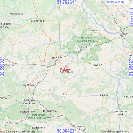
Maków GPS coordinates[2]
51° 20' 43.872" North, 21° 15' 11.304" East
| Map corner | latitude | longitude |
|---|---|---|
| Upper-left | 51.78261°, | 20.55002° |
| Center: | 51.34552°, | 21.25314° |
| Lower-right: | 50.90423°, | 21.95627° |
| Map W x H: | 97.7×97.7 km | = 60.7×60.7mi |
| max Lat: | 54.83135° ⇑46% North |
| Maków: | 51.34552° |
| min Lat: | ⇓54% South 49.21328° |
| min Long | Maków | max Long |
| 14.20249° | 21.25314° | 24.03723° |
| W 76.5%⇐ | ⇒23.5% E |
Elevation
Elevation of Maków is 180 m = 591 ft, and this is 11.4 m = 37 ft below average elevation for this country.
| Max E: |
974 m = 3196 ft | 47% |
| Avg. | 191.4 m = 628 ft | |
| Maków | 180 m = 591 ft | |
Min E: |
-3 m = -10 ft | 53% |
See also: Poland elevation on elevation.city.
Geographical zone
Maków is located in North temperate zone (between Tropic of Cancer and the Arctic Circle). Distance of this North polar circle is 1692.1 km =1051.4 mi to North.| Distance of | km | miles | from Maków |
|---|---|---|---|
| North Pole | 4298 | 2670.7 | to North |
| Arctic Circle | 1692.1 | 1051.4 | to North |
| Tropic Cancer | 3103.2 | 1928.2 | to South |
| Equator | 5709.1 | 3547.5 | to South |


Nearby cities:
15 places around Maków: (largest is in red/bold)
• Gózd
9.5 km =5.9 mi,  67°
67°
• Jastrzębia
16.9 km =10.5 mi,  356°
356°
• Jedlnia-Letnisko
11.1 km =6.9 mi,  31°
31°
• Kazanów
16.8 km =10.4 mi,  117°
117°
• Kowala
12.9 km =8 mi,  259°
259°
• Ludwinów
11 km =6.8 mi,  271°
271°
• Mazowszany
8.2 km =5.1 mi, 265°
• Pakosław
17.9 km =11.1 mi,  197°
197°
• Radom
9.7 km =6 mi,  310°
310°
• Rzeczków
16 km =9.9 mi,  236°
236°
• Skaryszew
3.9 km =2.4 mi,  180°
180°
• Sławno
17.4 km =10.8 mi,  285°
285°
• Tczów
13.6 km =8.5 mi,  99°
99°
• Trablice
8.7 km =5.4 mi,  275°
275°
• Wierzbica
16 km =9.9 mi,  227°
227°
Sources, notices
• [Note1] Compared only with cities in Poland existing in our database
• [Src1] Map data: © OpenStreetMap contributors (CC-BY-SA)
• [Src2] Other city data from geonames.org with taken over terms of usage.
• [Src3] Geographical zone / Annual Mean Temperature by Robert A. Rohde @ Wikipedia
