Kazanów geodata
Kazanów (Mazovia) is a seat of a third-order administrative division; located in Poland in Europe/Warsaw (GMT+2) time zone. With population of 460 people, there are 3556 cities with bigger population in this country. Compared to other cities in Poland, 52.6% of cities are located further ↓South; 78.8% of cities are located further ←West and 57.1% of cities have higher elevation than Kazanów. Note1


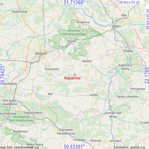
Kazanów GPS coordinates[2]
51° 16' 33.348" North, 21° 28' 2.532" East
| Map corner | latitude | longitude |
|---|---|---|
| Upper-left | 51.71368°, | 20.76425° |
| Center: | 51.27593°, | 21.46737° |
| Lower-right: | 50.83397°, | 22.1705° |
| Map W x H: | 97.8×97.8 km | = 60.8×60.8mi |
| max Lat: | 54.83135° ⇑47.4% North |
| Kazanów: | 51.27593° |
| min Lat: | ⇓52.6% South 49.21328° |
| min Long | Kazanów | max Long |
| 14.20249° | 21.46737° | 24.03723° |
| W 78.8%⇐ | ⇒21.2% E |
Elevation
Elevation of Kazanów is 153 m = 502 ft, and this is 38.4 m = 126 ft below average elevation for this country.
| Max E: |
974 m = 3196 ft | 57.1% |
| Avg. | 191.4 m = 628 ft | |
| Kazanów | 153 m = 502 ft | |
Min E: |
-3 m = -10 ft | 42.9% |
See also: Poland elevation on elevation.city.
Geographical zone
Kazanów is located in North temperate zone (between Tropic of Cancer and the Arctic Circle). Distance of this North polar circle is 1699.8 km =1056.2 mi to North.| Distance of | km | miles | from Kazanów |
|---|---|---|---|
| North Pole | 4305.7 | 2675.4 | to North |
| Arctic Circle | 1699.8 | 1056.2 | to North |
| Tropic Cancer | 3095.4 | 1923.4 | to South |
| Equator | 5701.3 | 3542.6 | to South |


Nearby cities:
15 places around Kazanów: (largest is in red/bold)
• Chotcza
21.9 km =13.6 mi,  100°
100°
• Ciepielów
8.1 km =5 mi,  112°
112°
• Gózd
12.9 km =8 mi,  331°
331°
• Iłża
20.2 km =12.6 mi,  231°
231°
• Jedlnia-Letnisko
19.5 km =12.1 mi, 331°
• Lipsko
18.1 km =11.2 mi,  135°
135°
• Maków
16.8 km =10.4 mi,  297°
297°
• Przyłęk
19.8 km =12.3 mi,  79°
79°
• Prędocin
17.3 km =10.7 mi,  214°
214°
• Rzeczniów
16.6 km =10.3 mi,  186°
186°
• Sienno
21 km =13 mi,  176°
176°
• Skaryszew
15.4 km =9.6 mi,  284°
284°
• Tczów
5.7 km =3.5 mi,  345°
345°
• Wielgie
4.3 km =2.7 mi,  152°
152°
• Zwoleń
12.2 km =7.6 mi,  43°
43°
Sources, notices
• [Note1] Compared only with cities in Poland existing in our database
• [Src1] Map data: © OpenStreetMap contributors (CC-BY-SA)
• [Src2] Other city data from geonames.org with taken over terms of usage.
• [Src3] Geographical zone / Annual Mean Temperature by Robert A. Rohde @ Wikipedia
