Gózd geodata
Gózd (Mazovia) is a seat of a third-order administrative division; located in Poland in Europe/Warsaw (GMT+2) time zone. With population of 909 people, there are 2661 cities with bigger population in this country. Compared to other cities in Poland, 54.6% of cities are located further ↓South; 77.8% of cities are located further ←West and 50.2% of cities have higher elevation than Gózd. Note1


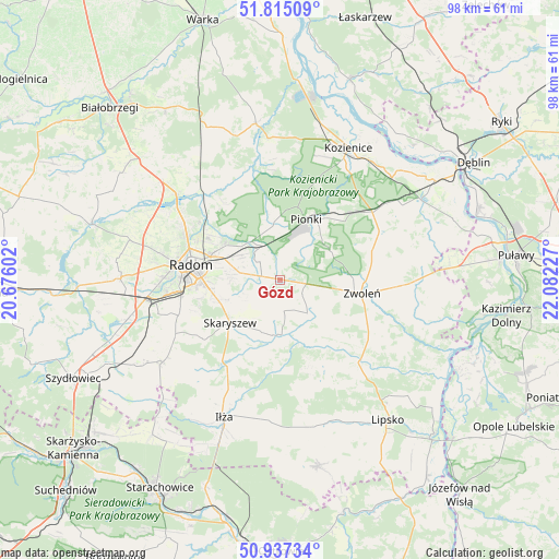
Gózd GPS coordinates[2]
51° 22' 41.952" North, 21° 22' 44.904" East
| Map corner | latitude | longitude |
|---|---|---|
| Upper-left | 51.81509°, | 20.67602° |
| Center: | 51.37832°, | 21.37914° |
| Lower-right: | 50.93734°, | 22.08227° |
| Map W x H: | 97.6×97.6 km | = 60.6×60.6mi |
| max Lat: | 54.83135° ⇑45.4% North |
| Gózd: | 51.37832° |
| min Lat: | ⇓54.6% South 49.21328° |
| min Long | Gózd | max Long |
| 14.20249° | 21.37914° | 24.03723° |
| W 77.8%⇐ | ⇒22.2% E |
Elevation
Elevation of Gózd is 171 m = 561 ft, and this is 20.4 m = 67 ft below average elevation for this country.
| Max E: |
974 m = 3196 ft | 50.2% |
| Avg. | 191.4 m = 628 ft | |
| Gózd | 171 m = 561 ft | |
Min E: |
-3 m = -10 ft | 49.8% |
See also: Poland elevation on elevation.city.
Geographical zone
Gózd is located in North temperate zone (between Tropic of Cancer and the Arctic Circle). Distance of this North polar circle is 1688.4 km =1049.1 mi to North.| Distance of | km | miles | from Gózd |
|---|---|---|---|
| North Pole | 4294.3 | 2668.4 | to North |
| Arctic Circle | 1688.4 | 1049.1 | to North |
| Tropic Cancer | 3106.8 | 1930.5 | to South |
| Equator | 5712.7 | 3549.7 | to South |


Nearby cities:
15 places around Gózd: (largest is in red/bold)
• Ciepielów
19.8 km =12.3 mi,  136°
136°
• Garbatka-Letnisko
19.8 km =12.3 mi,  54°
54°
• Jastrzębia
16.5 km =10.3 mi,  323°
323°
• Jedlnia-Letnisko
6.6 km =4.1 mi,  332°
332°
• Kazanów
12.9 km =8 mi,  151°
151°
• Maków
9.5 km =5.9 mi,  247°
247°
• Mazowszany
17.4 km =10.8 mi,  255°
255°
• Pionki
11.9 km =7.4 mi,  24°
24°
• Policzna
19.2 km =11.9 mi,  63°
63°
• Radom
16.3 km =10.1 mi,  279°
279°
• Skaryszew
11.6 km =7.2 mi,  229°
229°
• Tczów
7.5 km =4.7 mi, 141°
• Trablice
17.6 km =10.9 mi, 260°
• Wielgie
17.2 km =10.7 mi, 151°
• Zwoleń
14.7 km =9.1 mi,  99°
99°
Sources, notices
• [Note1] Compared only with cities in Poland existing in our database
• [Src1] Map data: © OpenStreetMap contributors (CC-BY-SA)
• [Src2] Other city data from geonames.org with taken over terms of usage.
• [Src3] Geographical zone / Annual Mean Temperature by Robert A. Rohde @ Wikipedia
