Koszyce geodata
Koszyce (Lesser Poland) is a populated place; located in Poland in Europe/Warsaw (GMT+2) time zone. With population of 830 people, there are 2797 cities with bigger population in this country. Compared to other cities in Poland, 75.3% of cities are located further ↑North; 66.1% of cities are located further ←West and 57.7% of cities have lower elevation than Koszyce. Note1


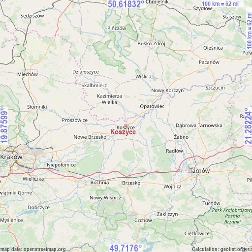
Koszyce GPS coordinates[2]
50° 10' 12.288" North, 20° 34' 44.796" East
| Map corner | latitude | longitude |
|---|---|---|
| Upper-left | 50.61832°, | 19.87599° |
| Center: | 50.17008°, | 20.57911° |
| Lower-right: | 49.7176°, | 21.28224° |
| Map W x H: | 100.2×100.1 km | = 62.3×62.2mi |
| max Lat: | 54.83135° ⇑75.3% North |
| Koszyce: | 50.17008° |
| min Lat: | ⇓24.7% South 49.21328° |
| min Long | Koszyce | max Long |
| 14.20249° | 20.57911° | 24.03723° |
| W 66.1%⇐ | ⇒33.9% E |
Elevation
Elevation of Koszyce is 193 m = 633 ft, and this is 1.6 m = 5 ft above average elevation for this country.
| Max E: |
974 m = 3196 ft | 42.3% |
| Koszyce | 193 m 633 ft | |
| Avg. | 191.4 m = 628 ft | |
Min E: |
-3 m = -10 ft | 57.7% |
See also: Poland elevation on elevation.city.
Geographical zone
Koszyce is located in North temperate zone (between Tropic of Cancer and the Arctic Circle). Distance of this North polar circle is 1822.8 km =1132.6 mi to North.| Distance of | km | miles | from Koszyce |
|---|---|---|---|
| North Pole | 4428.7 | 2751.9 | to North |
| Arctic Circle | 1822.8 | 1132.6 | to North |
| Tropic Cancer | 2972.5 | 1847 | to South |
| Equator | 5578.4 | 3466.3 | to South |


Nearby cities:
15 places around Koszyce: (largest is in red/bold)
• Bejsce
7.8 km =4.8 mi,  10°
10°
• Drwinia
12.6 km =7.8 mi,  230°
230°
• Dziewin
13.7 km =8.5 mi,  220°
220°
• Grobla
12 km =7.5 mi,  245°
245°
• Jadowniki Mokre
10.6 km =6.6 mi,  92°
92°
• Kazimierza Wielka
12.2 km =7.6 mi,  330°
330°
• Miechowice Małe
13.6 km =8.5 mi, 90°
• Miechowice Wielkie
12 km =7.5 mi,  78°
78°
• Opatowiec
13.1 km =8.1 mi,  51°
51°
• Rudy-Rysie
12.8 km =8 mi,  160°
160°
• Strzelce Wielkie
8.5 km =5.3 mi,  179°
179°
• Szczurowa
7 km =4.3 mi,  144°
144°
• Uście Solne
7.3 km =4.5 mi, 219°
• Wietrzychowice
13.4 km =8.3 mi, 80°
• Zaborów
8.3 km =5.2 mi,  108°
108°
Sources, notices
• [Note1] Compared only with cities in Poland existing in our database
• [Src1] Map data: © OpenStreetMap contributors (CC-BY-SA)
• [Src2] Other city data from geonames.org with taken over terms of usage.
• [Src3] Geographical zone / Annual Mean Temperature by Robert A. Rohde @ Wikipedia
