Koprzywnica geodata
Koprzywnica (Świętokrzyskie) is a seat of a third-order administrative division; located in Poland in Europe/Warsaw (GMT+2) time zone. With population of 2,536 people, there are 1230 cities with bigger population in this country. Compared to other cities in Poland, 65.2% of cities are located further ↑North; 80% of cities are located further ←West and 52.5% of cities have higher elevation than Koprzywnica. Note1
Administrative division(s):
- Level 1: Świętokrzyskie
- Level 2: Powiat sandomierski
- Level 3: Koprzywnica


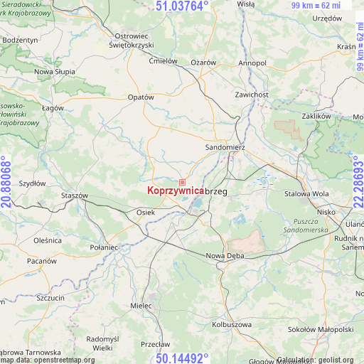
Koprzywnica GPS coordinates[2]
50° 35' 36.24" North, 21° 35' 1.68" East
| Map corner | latitude | longitude |
|---|---|---|
| Upper-left | 51.03764°, | 20.88068° |
| Center: | 50.5934°, | 21.5838° |
| Lower-right: | 50.14492°, | 22.28693° |
| Map W x H: | 99.3×99.3 km | = 61.7×61.7mi |
| max Lat: | 54.83135° ⇑65.2% North |
| Koprzywnica: | 50.5934° |
| min Lat: | ⇓34.8% South 49.21328° |
| min Long | Koprzywnica | max Long |
| 14.20249° | 21.5838° | 24.03723° |
| W 80%⇐ | ⇒20% E |
Elevation
Elevation of Koprzywnica is 165 m = 541 ft, and this is 26.4 m = 87 ft below average elevation for this country.
| Max E: |
974 m = 3196 ft | 52.5% |
| Avg. | 191.4 m = 628 ft | |
| Koprzywnica | 165 m = 541 ft | |
Min E: |
-3 m = -10 ft | 47.5% |
See also: Poland elevation on elevation.city.
Geographical zone
Koprzywnica is located in North temperate zone (between Tropic of Cancer and the Arctic Circle). Distance of this North polar circle is 1775.7 km =1103.4 mi to North.| Distance of | km | miles | from Koprzywnica |
|---|---|---|---|
| North Pole | 4381.6 | 2722.6 | to North |
| Arctic Circle | 1775.7 | 1103.4 | to North |
| Tropic Cancer | 3019.5 | 1876.2 | to South |
| Equator | 5625.5 | 3495.5 | to South |


Nearby cities:
15 places around Koprzywnica: (largest is in red/bold)
• Baranów Sandomierski
10.9 km =6.8 mi,  195°
195°
• Gorzyce
19.9 km =12.4 mi,  65°
65°
• Klimontów
11.4 km =7.1 mi,  307°
307°
• Lipnik
16.4 km =10.2 mi,  337°
337°
• Obrazów
12 km =7.5 mi,  23°
23°
• Osiek
12.9 km =8 mi,  230°
230°
• Padew Narodowa
18.1 km =11.2 mi, 198°
• Samborzec
7.5 km =4.7 mi,  37°
37°
• Sandomierz
15.3 km =9.5 mi,  49°
49°
• Sokolniki
16.5 km =10.3 mi, 72°
• Tarnobrzeg
7.1 km =4.4 mi,  108°
108°
• Wilczyce
17.9 km =11.1 mi, 16°
• Złota
10.4 km =6.5 mi, 42°
• Łoniów
5.2 km =3.2 mi, 231°
• Świniary Stare
7.3 km =4.5 mi,  210°
210°
Sources, notices
• [Note1] Compared only with cities in Poland existing in our database
• [Src1] Map data: © OpenStreetMap contributors (CC-BY-SA)
• [Src2] Other city data from geonames.org with taken over terms of usage.
• [Src3] Geographical zone / Annual Mean Temperature by Robert A. Rohde @ Wikipedia
