Novoraychikhinsk geodata
Novoraychikhinsk (Amur Oblast) is a populated place; located in Russia in Asia/Yakutsk (GMT+9) time zone. With population of 2,835 people, there are 3851 cities with bigger population in this country. Compared to other cities in Russia, 78.2% of cities are located further ↑North; 94.1% of cities are located further ←West and 59.5% of cities have lower elevation than Novoraychikhinsk. Note1


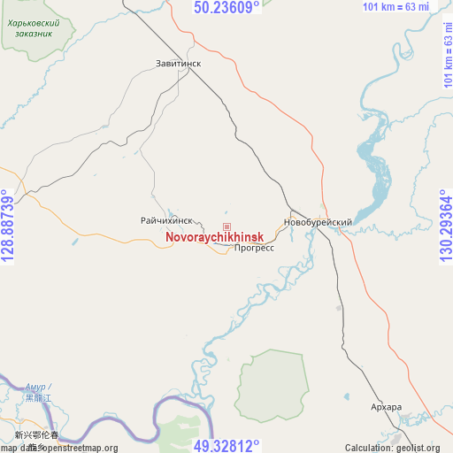
Novoraychikhinsk GPS coordinates[2]
49° 47' 3.228" North, 129° 35' 25.836" East
| Map corner | latitude | longitude |
|---|---|---|
| Upper-left | 50.23609°, | 128.88739° |
| Center: | 49.78423°, | 129.59051° |
| Lower-right: | 49.32812°, | 130.29364° |
| Map W x H: | 101×101 km | = 62.8×62.8mi |
| max Lat: | 73.50819° ⇑78.2% North |
| Novoraychikhinsk: | 49.78423° |
| min Lat: | ⇓21.8% South 41.28413° |
| min Long | Novoraychikhins | max Long |
| -179.12198° | 129.59051° | 179.35046° |
| W 94.1%⇐ | ⇒5.9% E |
Elevation
Elevation of Novoraychikhinsk is 167 m = 548 ft, and this is 35.6 m = 117 ft below average elevation for this country.
| Max E: |
2518 m = 8261 ft | 40.5% |
| Avg. | 202.6 m = 665 ft | |
| Novoraychikhinsk | 167 m = 548 ft | |
Min E: |
-28 m = -92 ft | 59.5% |
See also: Russia elevation on elevation.city.
Geographical zone
Novoraychikhinsk is located in North temperate zone (between Tropic of Cancer and the Arctic Circle). Distance of this North polar circle is 1865.7 km =1159.3 mi to North.| Distance of | km | miles | from Novoraychikhinsk |
|---|---|---|---|
| North Pole | 4471.6 | 2778.5 | to North |
| Arctic Circle | 1865.7 | 1159.3 | to North |
| Tropic Cancer | 2929.6 | 1820.4 | to South |
| Equator | 5535.5 | 3439.6 | to South |


Nearby cities:
15 places around Novoraychikhinsk: (largest is in red/bold)
• Arkhara
53.6 km =33.3 mi,  138°
138°
• Belogorsk
148.6 km =92.3 mi,  327°
327°
• Bureya
16.3 km =10.1 mi,  78°
78°
• Khingansk
136.9 km =85.1 mi,  122°
122°
• Konstantinovka
116.5 km =72.4 mi,  260°
260°
• Novobureyskiy
20.4 km =12.7 mi,  86°
86°
• Poyarkovo
69.6 km =43.2 mi, 255°
• Raychikhinsk
13 km =8.1 mi,  272°
272°
• Romny
106.3 km =66.1 mi,  348°
348°
• Shirokiy
5.8 km =3.6 mi,  241°
241°
• Srednebelaya
148.7 km =92.4 mi,  310°
310°
• Talakan
72 km =44.7 mi,  42°
42°
• Tambovka
115.2 km =71.6 mi,  287°
287°
• Yekaterinoslavka
74 km =46 mi, 332°
• Zavitinsk
37.9 km =23.5 mi,  343°
343°
Sources, notices
• [Note1] Compared only with cities in Russia existing in our database
• [Src1] Map data: © OpenStreetMap contributors (CC-BY-SA)
• [Src2] Other city data from geonames.org with taken over terms of usage.
• [Src3] Geographical zone / Annual Mean Temperature by Robert A. Rohde @ Wikipedia
