Raychikhinsk geodata
Raychikhinsk (Amur Oblast) is a populated place; located in Russia in Asia/Yakutsk (GMT+9) time zone. With population of 23,745 people, there are 772 cities with bigger population in this country. Compared to other cities in Russia, 78.2% of cities are located further ↑North; 94% of cities are located further ←West and 67.7% of cities have lower elevation than Raychikhinsk. Note1


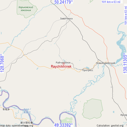
Raychikhinsk GPS coordinates[2]
49° 47' 23.928" North, 129° 24' 35.712" East
| Map corner | latitude | longitude |
|---|---|---|
| Upper-left | 50.24179°, | 128.7068° |
| Center: | 49.78998°, | 129.40992° |
| Lower-right: | 49.33392°, | 130.11305° |
| Map W x H: | 100.9×100.9 km | = 62.7×62.7mi |
| max Lat: | 73.50819° ⇑78.2% North |
| Raychikhinsk: | 49.78998° |
| min Lat: | ⇓21.8% South 41.28413° |
| min Long | Raychikhinsk | max Long |
| -179.12198° | 129.40992° | 179.35046° |
| W 94%⇐ | ⇒6% E |
Elevation
Elevation of Raychikhinsk is 190 m = 623 ft, and this is 12.6 m = 41 ft below average elevation for this country.
| Max E: |
2518 m = 8261 ft | 32.3% |
| Avg. | 202.6 m = 665 ft | |
| Raychikhinsk | 190 m = 623 ft | |
Min E: |
-28 m = -92 ft | 67.7% |
See also: Russia elevation on elevation.city.
Geographical zone
Raychikhinsk is located in North temperate zone (between Tropic of Cancer and the Arctic Circle). Distance of this North polar circle is 1865 km =1158.9 mi to North.| Distance of | km | miles | from Raychikhinsk |
|---|---|---|---|
| North Pole | 4470.9 | 2778.1 | to North |
| Arctic Circle | 1865 | 1158.9 | to North |
| Tropic Cancer | 2930.2 | 1820.7 | to South |
| Equator | 5536.1 | 3440 | to South |


Nearby cities:
15 places around Raychikhinsk: (largest is in red/bold)
• Arkhara
63.4 km =39.4 mi,  129°
129°
• Belogorsk
141.7 km =88 mi,  332°
332°
• Blagoveshchensk
144.2 km =89.6 mi,  292°
292°
• Bureya
29 km =18 mi,  85°
85°
• Konstantinovka
103.8 km =64.5 mi,  259°
259°
• Novobureyskiy
33.4 km =20.8 mi, 88°
• Novoraychikhinsk
13 km =8.1 mi, 92°
• Poyarkovo
57.3 km =35.6 mi,  251°
251°
• Romny
103.8 km =64.5 mi,  355°
355°
• Shirokiy
8.6 km =5.3 mi,  113°
113°
• Srednebelaya
138.8 km =86.2 mi,  314°
314°
• Talakan
80.8 km =50.2 mi,  49°
49°
• Tambovka
102.7 km =63.8 mi, 289°
• Yekaterinoslavka
68.3 km =42.4 mi,  341°
341°
• Zavitinsk
35.8 km =22.2 mi,  3°
3°
In other languages:
- In France: Raïtchikhinsk
- In German: Raitschichinsk
- In Italian: Rajčichinsk
- In Russian: Райчихинск
- In Chinese: 赖奇欣斯克
Sources, notices
• [Note1] Compared only with cities in Russia existing in our database
• [Src1] Map data: © OpenStreetMap contributors (CC-BY-SA)
• [Src2] Other city data from geonames.org with taken over terms of usage.
• [Src3] Geographical zone / Annual Mean Temperature by Robert A. Rohde @ Wikipedia
