Ash Shafā geodata
Ash Shafā (Makkah) is a populated place; located in Saudi Arabia in Asia/Riyadh (GMT+3) time zone. With population of 72,190 people, there are 30 cities with bigger population in this country. Compared to other cities in Saudi Arabia, 80.4% of cities are located further ↑North; 81.4% of cities are located further →East and 99% of cities have lower elevation than Ash Shafā. Note1


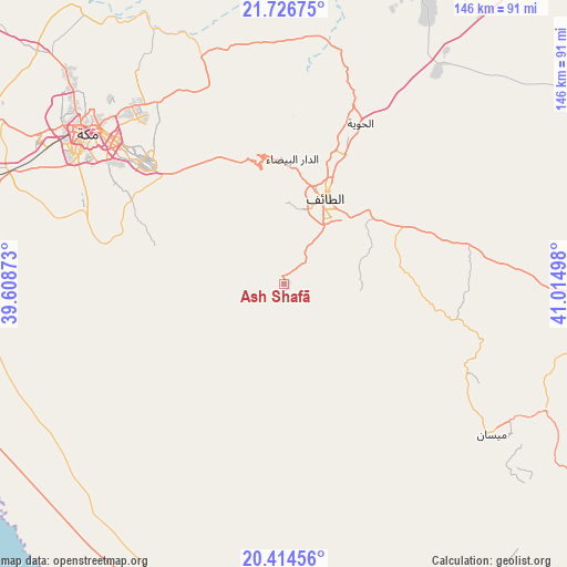
Ash Shafā GPS coordinates[2]
21° 4' 19.56" North, 40° 18' 42.66" East
| Map corner | latitude | longitude |
|---|---|---|
| Upper-left | 21.72675°, | 39.60873° |
| Center: | 21.0721°, | 40.31185° |
| Lower-right: | 20.41456°, | 41.01498° |
| Map W x H: | 145.9×145.9 km | = 90.7×90.7mi |
| max Lat: | 31.67252° ⇑80.4% North |
| Ash Shafā: | 21.0721° |
| min Lat: | ⇓19.6% South 16.57946° |
| min Long | Ash Shafā | max Long |
| 35.69014° | 40.31185° | 54.09599° |
| W 18.6%⇐ | ⇒81.4% E |
Elevation
Elevation of Ash Shafā is 2238 m = 7343 ft, and this is 1716.6 m = 5632 ft above average elevation for this country.
| Max E: |
2385 m = 7825 ft | 1% |
| Ash Shafā | 2238 m 7343 ft | |
| Avg. | 521.4 m = 1711 ft | |
Min E: |
3 m = 10 ft | 99% |
See also: Ash Shafā elevation on elevation.city.
Geographical zone
Ash Shafā is located in North Torrid zone (between Equator and Tropic of Cancer). Distance of this Northern Tropic circle is 262.9 km =163.4 mi to North.| Distance of | km | miles | from Ash Shafā |
|---|---|---|---|
| North Pole | 7664.1 | 4762.2 | to North |
| Arctic Circle | 5058.2 | 3143 | to North |
| Tropic Cancer | 262.9 | 163.4 | to North |
| Equator | 2343 | 1455.9 | to South |


Nearby cities:
15 places around Ash Shafā: (largest is in red/bold)
• Al Bahah
168.4 km =104.6 mi,  134°
134°
• Al Hadā
33 km =20.5 mi,  355°
355°
• Al Jumūm
87.8 km =54.6 mi,  313°
313°
• Al Majāridah
273.5 km =169.9 mi,  142°
142°
• Al Mindak
143.3 km =89 mi, 135°
• Al Muwayh
212.6 km =132.1 mi,  44°
44°
• An Nimāş
285.5 km =177.4 mi, 138°
• Badr Ḩunayn
339.6 km =211 mi,  332°
332°
• Jeddah
126.7 km =78.7 mi,  294°
294°
• Mecca
64 km =39.8 mi, 308°
• Qal‘at Bīshah
266.9 km =165.8 mi,  116°
116°
• Rābigh
232.8 km =144.7 mi, 325°
• Tabālah
250.7 km =155.8 mi, 119°
• Ta’if
24.5 km =15.2 mi,  26°
26°
• Turabah
137.9 km =85.7 mi,  83°
83°
Sources, notices
• [Note1] Compared only with cities in Saudi Arabia existing in our database
• [Src1] Map data: © OpenStreetMap contributors (CC-BY-SA)
• [Src2] Other city data from geonames.org with taken over terms of usage.
• [Src3] Geographical zone / Annual Mean Temperature by Robert A. Rohde @ Wikipedia
