Al Hadā geodata
Al Hadā (Makkah) is a populated place; located in Saudi Arabia in Asia/Riyadh (GMT+3) time zone. With population of 6,885 people, there are 81 cities with bigger population in this country. Compared to other cities in Saudi Arabia, 77.3% of cities are located further ↑North; 82.5% of cities are located further →East and 93.8% of cities have lower elevation than Al Hadā. Note1


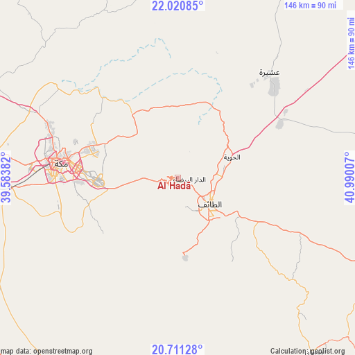
Al Hadā GPS coordinates[2]
21° 22' 3.108" North, 40° 17' 12.984" East
| Map corner | latitude | longitude |
|---|---|---|
| Upper-left | 22.02085°, | 39.58382° |
| Center: | 21.36753°, | 40.28694° |
| Lower-right: | 20.71128°, | 40.99007° |
| Map W x H: | 145.6×145.6 km | = 90.5×90.5mi |
| max Lat: | 31.67252° ⇑77.3% North |
| Al Hadā: | 21.36753° |
| min Lat: | ⇓22.7% South 16.57946° |
| min Long | Al Hadā | max Long |
| 35.69014° | 40.28694° | 54.09599° |
| W 17.5%⇐ | ⇒82.5% E |
Elevation
Elevation of Al Hadā is 1977 m = 6486 ft, and this is 1455.6 m = 4776 ft above average elevation for this country.
| Max E: |
2385 m = 7825 ft | 6.2% |
| Al Hadā | 1977 m 6486 ft | |
| Avg. | 521.4 m = 1711 ft | |
Min E: |
3 m = 10 ft | 93.8% |
See also: Saudi Arabia elevation on elevation.city.
Geographical zone
Al Hadā is located in North Torrid zone (between Equator and Tropic of Cancer). Distance of this Northern Tropic circle is 230.1 km =143 mi to North.| Distance of | km | miles | from Al Hadā |
|---|---|---|---|
| North Pole | 7631.2 | 4741.8 | to North |
| Arctic Circle | 5025.3 | 3122.6 | to North |
| Tropic Cancer | 230.1 | 143 | to North |
| Equator | 2375.8 | 1476.3 | to South |


Nearby cities:
15 places around Al Hadā: (largest is in red/bold)
• Al Bahah
194.3 km =120.7 mi,  140°
140°
• Al Jumūm
66.9 km =41.6 mi,  294°
294°
• Al Majāridah
301.6 km =187.4 mi,  145°
145°
• Al Mindak
169.7 km =105.4 mi, 142°
• Al Muwayh
192.6 km =119.7 mi,  52°
52°
• An Nimāş
312.4 km =194.1 mi, 142°
• Ash Shafā
33 km =20.5 mi,  175°
175°
• Badr Ḩunayn
309.4 km =192.3 mi,  330°
330°
• Jeddah
114.4 km =71.1 mi,  279°
279°
• Mecca
48.2 km =30 mi, 277°
• Qal‘at Bīshah
285 km =177.1 mi,  122°
122°
• Rābigh
204.8 km =127.3 mi,  320°
320°
• Tabālah
270.5 km =168.1 mi,  125°
125°
• Ta’if
17.2 km =10.7 mi, 129°
• Turabah
140.5 km =87.3 mi,  96°
96°
Sources, notices
• [Note1] Compared only with cities in Saudi Arabia existing in our database
• [Src1] Map data: © OpenStreetMap contributors (CC-BY-SA)
• [Src2] Other city data from geonames.org with taken over terms of usage.
• [Src3] Geographical zone / Annual Mean Temperature by Robert A. Rohde @ Wikipedia
