Bārah geodata
Bārah (North Kordofan) is a seat of a second-order administrative division; located in Sudan in Africa/Khartoum (GMT+2) time zone. With population of 16,969 people, there are 45 cities with bigger population in this country. Compared to other cities in Sudan, 50.7% of cities are located further ↑North; 76.1% of cities are located further →East and 64.8% of cities have lower elevation than Bārah. Note1


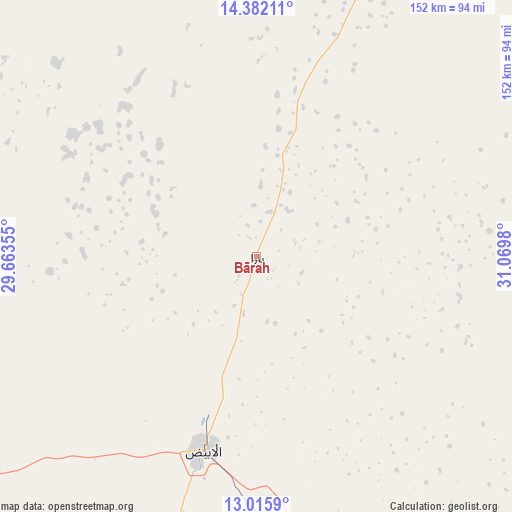
Bārah GPS coordinates[2]
13° 42' 0" North, 30° 22' 0.012" East
| Map corner | latitude | longitude |
|---|---|---|
| Upper-left | 14.38211°, | 29.66355° |
| Center: | 13.7°, | 30.36667° |
| Lower-right: | 13.0159°, | 31.0698° |
| Map W x H: | 151.9×151.9 km | = 94.4×94.4mi |
| max Lat: | 21.06667° ⇑50.7% North |
| Bārah: | 13.7° |
| min Lat: | ⇓49.3% South 10.55° |
| min Long | Bārah | max Long |
| 22.44725° | 30.36667° | 37.729° |
| W 23.9%⇐ | ⇒76.1% E |
Elevation
Elevation of Bārah is 478 m = 1568 ft, and this is 28.9 m = 95 ft above average elevation for this country.
| Max E: |
1159 m = 3802 ft | 35.2% |
| Bārah | 478 m 1568 ft | |
| Avg. | 449.1 m = 1473 ft | |
Min E: |
4 m = 13 ft | 64.8% |
See also: Sudan elevation on elevation.city.
Geographical zone
Bārah is located in North Torrid zone (between Equator and Tropic of Cancer). Distance of this Northern Tropic circle is 1082.6 km =672.7 mi to North.| Distance of | km | miles | from Bārah |
|---|---|---|---|
| North Pole | 8483.8 | 5271.6 | to North |
| Arctic Circle | 5877.9 | 3652.4 | to North |
| Tropic Cancer | 1082.6 | 672.7 | to North |
| Equator | 1523.3 | 946.5 | to South |


Nearby cities:
15 places around Bārah: (largest is in red/bold)
• Abū Zabad
192.8 km =119.8 mi,  218°
218°
• Ad Douiem
212.6 km =132.1 mi,  80°
80°
• Al Kawa
230.4 km =143.2 mi,  88°
88°
• Al Qiţena
251.4 km =156.2 mi,  58°
58°
• An Nuhūd
237 km =147.3 mi,  242°
242°
• Ar Rahad
113.6 km =70.6 mi,  164°
164°
• Dilling
199.2 km =123.8 mi,  202°
202°
• El Obeid
59.6 km =37 mi, 195°
• Kosti
255.5 km =158.8 mi,  103°
103°
• Marabba
247.5 km =153.8 mi,  127°
127°
• Rabak
263.1 km =163.5 mi, 102°
• Tandaltī
179.2 km =111.3 mi,  115°
115°
• Um Jar Al Gharbiyya
220.7 km =137.1 mi, 87°
• Umm Ruwaba
127.4 km =79.2 mi, 133°
• Wad az Zāki
215.7 km =134 mi,  66°
66°
Sources, notices
• [Note1] Compared only with cities in Sudan existing in our database
• [Src1] Map data: © OpenStreetMap contributors (CC-BY-SA)
• [Src2] Other city data from geonames.org with taken over terms of usage.
• [Src3] Geographical zone / Annual Mean Temperature by Robert A. Rohde @ Wikipedia
