El Obeid geodata
El Obeid (North Kordofan) is a seat of a first-order administrative division; located in Sudan in Africa/Khartoum (GMT+2) time zone. With population of 393,311 people, there are 5 cities with bigger population in this country. Compared to other cities in Sudan, 64.8% of cities are located further ↑North; 77.5% of cities are located further →East and 83.1% of cities have lower elevation than El Obeid. Note1


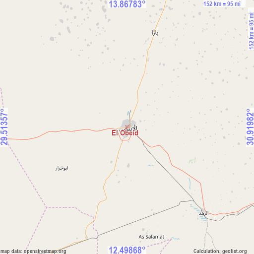
El Obeid GPS coordinates[2]
13° 11' 3.156" North, 30° 13' 0.084" East
| Map corner | latitude | longitude |
|---|---|---|
| Upper-left | 13.86783°, | 29.51357° |
| Center: | 13.18421°, | 30.21669° |
| Lower-right: | 12.49868°, | 30.91982° |
| Map W x H: | 152.2×152.2 km | = 94.6×94.6mi |
| max Lat: | 21.06667° ⇑64.8% North |
| El Obeid: | 13.18421° |
| min Lat: | ⇓35.2% South 10.55° |
| min Long | El Obeid | max Long |
| 22.44725° | 30.21669° | 37.729° |
| W 22.5%⇐ | ⇒77.5% E |
Elevation
Elevation of El Obeid is 573 m = 1880 ft, and this is 123.9 m = 406 ft above average elevation for this country.
| Max E: |
1159 m = 3802 ft | 16.9% |
| El Obeid | 573 m 1880 ft | |
| Avg. | 449.1 m = 1473 ft | |
Min E: |
4 m = 13 ft | 83.1% |
See also: El Obeid elevation on elevation.city.
Geographical zone
El Obeid is located in North Torrid zone (between Equator and Tropic of Cancer). Distance of this Northern Tropic circle is 1140 km =708.4 mi to North.| Distance of | km | miles | from El Obeid |
|---|---|---|---|
| North Pole | 8541.1 | 5307.2 | to North |
| Arctic Circle | 5935.2 | 3688 | to North |
| Tropic Cancer | 1140 | 708.4 | to North |
| Equator | 1465.9 | 910.9 | to South |


Nearby cities:
15 places around El Obeid: (largest is in red/bold)
• Abu Jibeha
221.4 km =137.6 mi,  150°
150°
• Abū Zabad
140 km =87 mi,  228°
228°
• Ad Douiem
243.9 km =151.6 mi,  68°
68°
• Al Kawa
254.6 km =158.2 mi,  75°
75°
• Al Lagowa
230.7 km =143.4 mi,  210°
210°
• An Nuhūd
200.6 km =124.6 mi,  254°
254°
• Ar Rahad
70.1 km =43.6 mi,  137°
137°
• Bārah
59.6 km =37 mi,  15°
15°
• Dilling
140.3 km =87.2 mi, 205°
• Kadugli
247.6 km =153.9 mi,  192°
192°
• Marabba
232.6 km =144.5 mi,  113°
113°
• Tandaltī
179.7 km =111.7 mi,  95°
95°
• Um Jar Al Gharbiyya
246.6 km =153.2 mi, 73°
• Umm Ruwaba
112.6 km =70 mi, 105°
• Wad az Zāki
257.6 km =160.1 mi,  56°
56°
Sources, notices
• [Note1] Compared only with cities in Sudan existing in our database
• [Src1] Map data: © OpenStreetMap contributors (CC-BY-SA)
• [Src2] Other city data from geonames.org with taken over terms of usage.
• [Src3] Geographical zone / Annual Mean Temperature by Robert A. Rohde @ Wikipedia
