Ar Rahad geodata
Ar Rahad (North Kordofan) is a populated place; located in Sudan in Africa/Khartoum (GMT+2) time zone. With population of 26,273 people, there are 33 cities with bigger population in this country. Compared to other cities in Sudan, 74.6% of cities are located further ↑North; 69% of cities are located further →East and 71.8% of cities have lower elevation than Ar Rahad. Note1


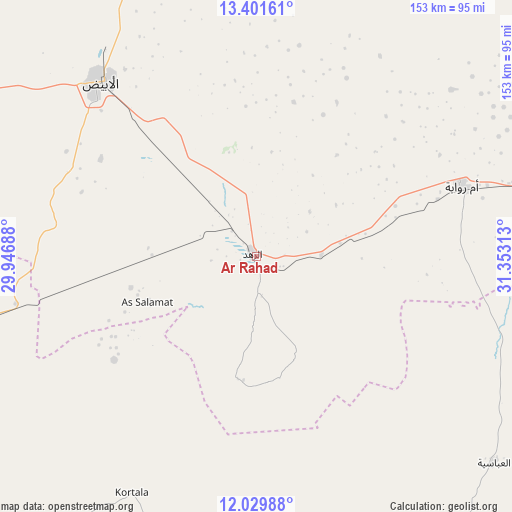
Ar Rahad GPS coordinates[2]
12° 43' 0.012" North, 30° 39' 0" East
| Map corner | latitude | longitude |
|---|---|---|
| Upper-left | 13.40161°, | 29.94688° |
| Center: | 12.71667°, | 30.65° |
| Lower-right: | 12.02988°, | 31.35313° |
| Map W x H: | 152.5×152.5 km | = 94.8×94.8mi |
| max Lat: | 21.06667° ⇑74.6% North |
| Ar Rahad: | 12.71667° |
| min Lat: | ⇓25.4% South 10.55° |
| min Long | Ar Rahad | max Long |
| 22.44725° | 30.65° | 37.729° |
| W 31%⇐ | ⇒69% E |
Elevation
Elevation of Ar Rahad is 506 m = 1660 ft, and this is 56.9 m = 187 ft above average elevation for this country.
| Max E: |
1159 m = 3802 ft | 28.2% |
| Ar Rahad | 506 m 1660 ft | |
| Avg. | 449.1 m = 1473 ft | |
Min E: |
4 m = 13 ft | 71.8% |
See also: Sudan elevation on elevation.city.
Geographical zone
Ar Rahad is located in North Torrid zone (between Equator and Tropic of Cancer). Distance of this Northern Tropic circle is 1192 km =740.7 mi to North.| Distance of | km | miles | from Ar Rahad |
|---|---|---|---|
| North Pole | 8593.1 | 5339.5 | to North |
| Arctic Circle | 5987.2 | 3720.3 | to North |
| Tropic Cancer | 1192 | 740.7 | to North |
| Equator | 1414 | 878.6 | to South |


Nearby cities:
15 places around Ar Rahad: (largest is in red/bold)
• Abu Jibeha
153.6 km =95.4 mi,  155°
155°
• Abū Zabad
157.3 km =97.7 mi,  254°
254°
• Ad Douiem
229.6 km =142.7 mi,  51°
51°
• Al Kawa
230.6 km =143.3 mi,  60°
60°
• Al Lagowa
220.5 km =137 mi,  228°
228°
• Bārah
113.6 km =70.6 mi,  344°
344°
• Dilling
131.5 km =81.7 mi,  235°
235°
• El Obeid
70.1 km =43.6 mi,  317°
317°
• Kadugli
215 km =133.6 mi,  208°
208°
• Kosti
223.8 km =139.1 mi,  77°
77°
• Marabba
171.3 km =106.4 mi,  103°
103°
• Rabak
232.3 km =144.3 mi, 77°
• Tandaltī
136 km =84.5 mi, 75°
• Um Jar Al Gharbiyya
225.2 km =139.9 mi, 57°
• Umm Ruwaba
64.9 km =40.3 mi,  71°
71°
Sources, notices
• [Note1] Compared only with cities in Sudan existing in our database
• [Src1] Map data: © OpenStreetMap contributors (CC-BY-SA)
• [Src2] Other city data from geonames.org with taken over terms of usage.
• [Src3] Geographical zone / Annual Mean Temperature by Robert A. Rohde @ Wikipedia
