Umm Ruwaba geodata
Umm Ruwaba (North Kordofan) is a populated place; located in Sudan in Africa/Khartoum (GMT+2) time zone. With population of 55,742 people, there are 23 cities with bigger population in this country. Compared to other cities in Sudan, 73.2% of cities are located further ↑North; 66.2% of cities are located further →East and 62% of cities have lower elevation than Umm Ruwaba. Note1


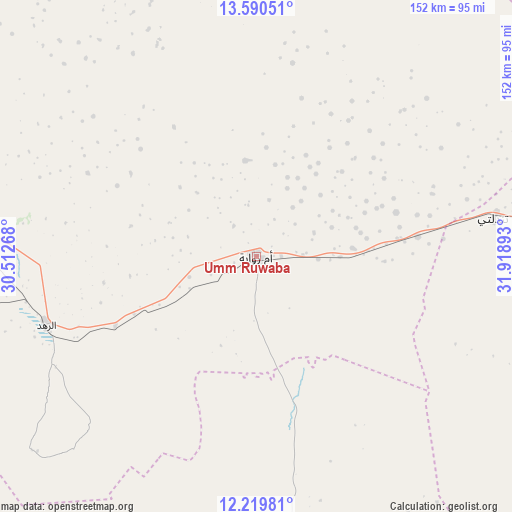
Umm Ruwaba GPS coordinates[2]
12° 54' 21.96" North, 31° 12' 56.88" East
| Map corner | latitude | longitude |
|---|---|---|
| Upper-left | 13.59051°, | 30.51268° |
| Center: | 12.9061°, | 31.2158° |
| Lower-right: | 12.21981°, | 31.91893° |
| Map W x H: | 152.4×152.4 km | = 94.7×94.7mi |
| max Lat: | 21.06667° ⇑73.2% North |
| Umm Ruwaba: | 12.9061° |
| min Lat: | ⇓26.8% South 10.55° |
| min Long | Umm Ruwaba | max Long |
| 22.44725° | 31.2158° | 37.729° |
| W 33.8%⇐ | ⇒66.2% E |
Elevation
Elevation of Umm Ruwaba is 457 m = 1499 ft, and this is 7.9 m = 26 ft above average elevation for this country.
| Max E: |
1159 m = 3802 ft | 38% |
| Umm Ruwaba | 457 m 1499 ft | |
| Avg. | 449.1 m = 1473 ft | |
Min E: |
4 m = 13 ft | 62% |
See also: Umm Ruwaba elevation on elevation.city.
Geographical zone
Umm Ruwaba is located in North Torrid zone (between Equator and Tropic of Cancer). Distance of this Northern Tropic circle is 1170.9 km =727.6 mi to North.| Distance of | km | miles | from Umm Ruwaba |
|---|---|---|---|
| North Pole | 8572 | 5326.4 | to North |
| Arctic Circle | 5966.2 | 3707.2 | to North |
| Tropic Cancer | 1170.9 | 727.6 | to North |
| Equator | 1435 | 891.7 | to South |


Nearby cities:
15 places around Umm Ruwaba: (largest is in red/bold)
• Abu Jibeha
161.2 km =100.2 mi,  179°
179°
• Abū Zabad
222.1 km =138 mi,  253°
253°
• Ad Douiem
169.9 km =105.6 mi,  44°
44°
• Al Kawa
167.4 km =104 mi,  56°
56°
• Al Manāqil
242.7 km =150.8 mi,  52°
52°
• Ar Rahad
64.9 km =40.3 mi, 251°
• Bārah
127.4 km =79.2 mi,  313°
313°
• Dilling
194.8 km =121 mi,  240°
240°
• El Obeid
112.6 km =70 mi,  285°
285°
• Kosti
159.4 km =99 mi,  79°
79°
• Marabba
121.8 km =75.7 mi,  120°
120°
• Rabak
167.9 km =104.3 mi, 79°
• Tandaltī
71.6 km =44.5 mi, 80°
• Um Jar Al Gharbiyya
162.9 km =101.2 mi, 52°
• Wad az Zāki
203.4 km =126.4 mi,  31°
31°
Sources, notices
• [Note1] Compared only with cities in Sudan existing in our database
• [Src1] Map data: © OpenStreetMap contributors (CC-BY-SA)
• [Src2] Other city data from geonames.org with taken over terms of usage.
• [Src3] Geographical zone / Annual Mean Temperature by Robert A. Rohde @ Wikipedia
