Malå geodata
Malå (Västerbotten) is a seat of a second-order administrative division; located in Sweden in Europe/Stockholm (GMT+2) time zone. With population of 2,043 people, there are 513 cities with bigger population in this country. Compared to other cities in Sweden, 96.2% of cities are located further ↓South; 92.3% of cities are located further ←West and 97.2% of cities have lower elevation than Malå. Note1


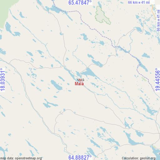
Malå GPS coordinates[2]
65° 11' 6.036" North, 18° 44' 32.748" East
| Map corner | latitude | longitude |
|---|---|---|
| Upper-left | 65.47847°, | 18.03931° |
| Center: | 65.18501°, | 18.74243° |
| Lower-right: | 64.88827°, | 19.44556° |
| Map W x H: | 65.6×65.6 km | = 40.8×40.8mi |
| max Lat: | 67.85572° ⇑3.8% North |
| Malå: | 65.18501° |
| min Lat: | ⇓96.2% South 55.34337° |
| min Long | Malå | max Long |
| 11.1712° | 18.74243° | 24.13676° |
| W 92.3%⇐ | ⇒7.7% E |
Elevation
Elevation of Malå is 324 m = 1063 ft, and this is 241.4 m = 792 ft above average elevation for this country.
| Max E: |
663 m = 2175 ft | 2.8% |
| Malå | 324 m 1063 ft | |
| Avg. | 82.6 m = 271 ft | |
Min E: |
-1 m = -3 ft | 97.2% |
See also: Sweden elevation on elevation.city.
Geographical zone
Malå is located in North temperate zone (between Tropic of Cancer and the Arctic Circle). Distance of this North polar circle is 153.3 km =95.3 mi to North.| Distance of | km | miles | from Malå |
|---|---|---|---|
| North Pole | 2759.2 | 1714.5 | to North |
| Arctic Circle | 153.3 | 95.3 | to North |
| Tropic Cancer | 4642 | 2884.4 | to South |
| Equator | 7247.9 | 4503.6 | to South |


Nearby cities:
15 places around Malå: (largest is in red/bold)
• Arvidsjaur
49.2 km =30.6 mi,  23°
23°
• Boliden
84.8 km =52.7 mi,  114°
114°
• Forsbacka
94.8 km =58.9 mi,  119°
119°
• Guojkkasuoluoj
59.4 km =36.9 mi,  329°
329°
• Jörn
62.2 km =38.6 mi,  102°
102°
• Lycksele
65.6 km =40.8 mi,  182°
182°
• Långsele
81.8 km =50.8 mi, 120°
• Norsjö
46.1 km =28.6 mi,  131°
131°
• Sorsele
68.1 km =42.3 mi,  304°
304°
• Storuman
76.6 km =47.6 mi,  262°
262°
• Storvik
93 km =57.8 mi,  92°
92°
• Svartå
96.2 km =59.8 mi, 100°
• Söderfors
52.3 km =32.5 mi,  218°
218°
• Tallåsen
98.5 km =61.2 mi, 177°
• Tällberg
99 km =61.5 mi, 103°
Sources, notices
• [Note1] Compared only with cities in Sweden existing in our database
• [Src1] Map data: © OpenStreetMap contributors (CC-BY-SA)
• [Src2] Other city data from geonames.org with taken over terms of usage.
• [Src3] Geographical zone / Annual Mean Temperature by Robert A. Rohde @ Wikipedia
