Guojkkasuoluoj geodata
Guojkkasuoluoj (Norrbotten) is a populated place; located in Sweden in Europe/Stockholm (GMT+2) time zone. With population of 594 people, there are 1181 cities with bigger population in this country. Compared to other cities in Sweden, 97.6% of cities are located further ↓South; 87.1% of cities are located further ←West and 98.9% of cities have lower elevation than Guojkkasuoluoj. Note1


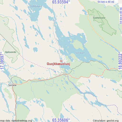
Guojkkasuoluoj GPS coordinates[2]
65° 38' 51.432" North, 18° 5' 56.724" East
| Map corner | latitude | longitude |
|---|---|---|
| Upper-left | 65.93594°, | 17.39597° |
| Center: | 65.64762°, | 18.09909° |
| Lower-right: | 65.35606°, | 18.80222° |
| Map W x H: | 64.5×64.5 km | = 40.1×40.1mi |
| max Lat: | 67.85572° ⇑2.4% North |
| Guojkkasuoluoj: | 65.64762° |
| min Lat: | ⇓97.6% South 55.34337° |
| min Long | Guojkkasuoluoj | max Long |
| 11.1712° | 18.09909° | 24.13676° |
| W 87.1%⇐ | ⇒12.9% E |
Elevation
Elevation of Guojkkasuoluoj is 410 m = 1345 ft, and this is 327.4 m = 1074 ft above average elevation for this country.
| Max E: |
663 m = 2175 ft | 1.1% |
| Guojkkasuoluoj | 410 m 1345 ft | |
| Avg. | 82.6 m = 271 ft | |
Min E: |
-1 m = -3 ft | 98.9% |
See also: Sweden elevation on elevation.city.
Geographical zone
Guojkkasuoluoj is located in North temperate zone (between Tropic of Cancer and the Arctic Circle). Distance of this North polar circle is 101.8 km =63.3 mi to North.| Distance of | km | miles | from Guojkkasuoluoj |
|---|---|---|---|
| North Pole | 2707.7 | 1682.5 | to North |
| Arctic Circle | 101.8 | 63.3 | to North |
| Tropic Cancer | 4693.4 | 2916.3 | to South |
| Equator | 7299.3 | 4535.6 | to South |


Nearby cities:
15 places around Guojkkasuoluoj: (largest is in red/bold)
• Arjeplog
46 km =28.6 mi,  347°
347°
• Arvidsjaur
49.4 km =30.7 mi,  97°
97°
• Björkvik
117.6 km =73.1 mi,  261°
261°
• Jokkmokk
131.9 km =82 mi,  36°
36°
• Jörn
111.2 km =69.1 mi,  126°
126°
• Lycksele
120 km =74.6 mi,  167°
167°
• Malå
59.4 km =36.9 mi,  149°
149°
• Norsjö
104 km =64.6 mi,  141°
141°
• Sorsele
28.7 km =17.8 mi,  244°
244°
• Storuman
76.4 km =47.5 mi,  216°
216°
• Söderfors
92.4 km =57.4 mi,  181°
181°
• Vidsel
112.5 km =69.9 mi,  79°
79°
• Vilhelmina
132.3 km =82.2 mi,  210°
210°
• Ånäset
130 km =80.8 mi, 99°
• Östansjö
55.9 km =34.7 mi,  332°
332°
Sources, notices
• [Note1] Compared only with cities in Sweden existing in our database
• [Src1] Map data: © OpenStreetMap contributors (CC-BY-SA)
• [Src2] Other city data from geonames.org with taken over terms of usage.
• [Src3] Geographical zone / Annual Mean Temperature by Robert A. Rohde @ Wikipedia
