Gällivare geodata
Gällivare (Norrbotten) is a seat of a second-order administrative division; located in Sweden in Europe/Stockholm (GMT+2) time zone. With population of 10,362 people, there are 146 cities with bigger population in this country. Compared to other cities in Sweden, 99.5% of cities are located further ↓South; 95.6% of cities are located further ←West and 98.2% of cities have lower elevation than Gällivare. Note1


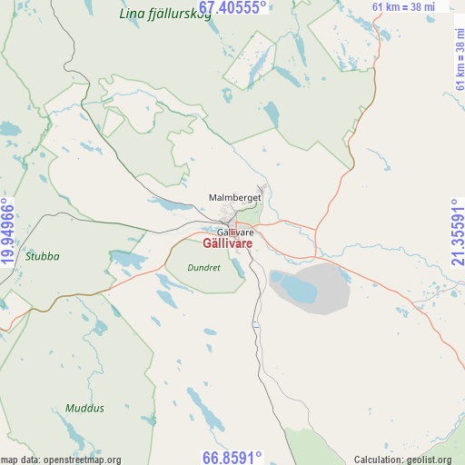
Gällivare GPS coordinates[2]
67° 8' 1.932" North, 20° 39' 10.008" East
| Map corner | latitude | longitude |
|---|---|---|
| Upper-left | 67.40555°, | 19.94966° |
| Center: | 67.13387°, | 20.65278° |
| Lower-right: | 66.8591°, | 21.35591° |
| Map W x H: | 60.8×60.8 km | = 37.8×37.8mi |
| max Lat: | 67.85572° ⇑0.5% North |
| Gällivare: | 67.13387° |
| min Lat: | ⇓99.5% South 55.34337° |
| min Long | Gällivare | max Long |
| 11.1712° | 20.65278° | 24.13676° |
| W 95.6%⇐ | ⇒4.4% E |
Elevation
Elevation of Gällivare is 363 m = 1191 ft, and this is 280.4 m = 920 ft above average elevation for this country.
| Max E: |
663 m = 2175 ft | 1.8% |
| Gällivare | 363 m 1191 ft | |
| Avg. | 82.6 m = 271 ft | |
Min E: |
-1 m = -3 ft | 98.2% |
See also: Sweden elevation on elevation.city.
Geographical zone
Gällivare is located in North Frigid zone (between North Pole and Arctic Circle). Distance of this North polar circle is 63.4 km =39.4 mi to South.| Distance of | km | miles | from Gällivare |
|---|---|---|---|
| North Pole | 2542.5 | 1579.8 | to North |
| Arctic Circle | 63.4 | 39.4 | to South |
| Tropic Cancer | 4858.7 | 3019.1 | to South |
| Equator | 7464.6 | 4638.3 | to South |


Nearby cities:
15 places around Gällivare: (largest is in red/bold)
• Boden
152.6 km =94.8 mi,  162°
162°
• Jokkmokk
68.9 km =42.8 mi,  211°
211°
• Jukkasjärvi
79.6 km =49.5 mi,  358°
358°
• Kiruna
82.3 km =51.1 mi,  347°
347°
• Korpilombolo
109 km =67.7 mi,  106°
106°
• Koskullskulle
6.9 km =4.3 mi,  37°
37°
• Långvik
132.9 km =82.6 mi,  148°
148°
• Malmberget
4.6 km =2.9 mi,  1°
1°
• Pajala
117.4 km =72.9 mi,  85°
85°
• Tuolluvaara
80.8 km =50.2 mi, 350°
• Vidsel
144.5 km =89.8 mi,  182°
182°
• Vittangi
73.6 km =45.7 mi, 35°
• Vuollerim
78.2 km =48.6 mi, 180°
• Överkalix
131.5 km =81.7 mi,  132°
132°
• Övertorneå
155.6 km =96.7 mi,  122°
122°
Sources, notices
• [Note1] Compared only with cities in Sweden existing in our database
• [Src1] Map data: © OpenStreetMap contributors (CC-BY-SA)
• [Src2] Other city data from geonames.org with taken over terms of usage.
• [Src3] Geographical zone / Annual Mean Temperature by Robert A. Rohde @ Wikipedia
