Kiruna geodata
Kiruna (Norrbotten) is a seat of a second-order administrative division; located in Sweden in Europe/Stockholm (GMT+2) time zone. With population of 17,037 people, there are 92 cities with bigger population in this country. Compared to other cities in Sweden, 100% of cities are located further ↓South; 94.3% of cities are located further ←West and 99.9% of cities have lower elevation than Kiruna. Note1


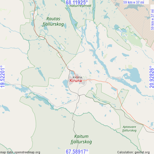
Kiruna GPS coordinates[2]
67° 51' 20.592" North, 20° 13' 30.468" East
| Map corner | latitude | longitude |
|---|---|---|
| Upper-left | 68.11925°, | 19.52201° |
| Center: | 67.85572°, | 20.22513° |
| Lower-right: | 67.58917°, | 20.92826° |
| Map W x H: | 58.9×58.9 km | = 36.6×36.6mi |
| max Lat: | 67.85572° ⇑0% North |
| Kiruna: | 67.85572° |
| min Lat: | ⇓100% South 55.34337° |
| min Long | Kiruna | max Long |
| 11.1712° | 20.22513° | 24.13676° |
| W 94.3%⇐ | ⇒5.7% E |
Elevation
Elevation of Kiruna is 579 m = 1900 ft, and this is 496.4 m = 1629 ft above average elevation for this country.
| Max E: |
663 m = 2175 ft | 0.099999999999994% |
| Kiruna | 579 m 1900 ft | |
| Avg. | 82.6 m = 271 ft | |
Min E: |
-1 m = -3 ft | 99.9% |
See also: Sweden elevation on elevation.city.
Geographical zone
Kiruna is located in North Frigid zone (between North Pole and Arctic Circle). Distance of this North polar circle is 143.7 km =89.3 mi to South.| Distance of | km | miles | from Kiruna |
|---|---|---|---|
| North Pole | 2462.2 | 1529.9 | to North |
| Arctic Circle | 143.7 | 89.3 | to South |
| Tropic Cancer | 4938.9 | 3068.9 | to South |
| Equator | 7544.8 | 4688.1 | to South |


Nearby cities:
15 places around Kiruna: (largest is in red/bold)
• Arjeplog
224.9 km =139.7 mi,  206°
206°
• Gällivare
82.3 km =51.1 mi,  167°
167°
• Jokkmokk
140 km =87 mi,  187°
187°
• Jukkasjärvi
16.4 km =10.2 mi,  92°
92°
• Korpilombolo
164.7 km =102.3 mi,  132°
132°
• Koskullskulle
78 km =48.5 mi,  163°
163°
• Långvik
212.1 km =131.8 mi, 155°
• Malmberget
77.8 km =48.3 mi, 166°
• Pajala
151.4 km =94.1 mi,  118°
118°
• Tuolluvaara
4.6 km =2.9 mi,  97°
97°
• Vidsel
225 km =139.8 mi,  176°
176°
• Vittangi
62.9 km =39.1 mi,  108°
108°
• Vuollerim
159.4 km =99 mi, 173°
• Överkalix
204.2 km =126.9 mi,  146°
146°
• Övertorneå
220.4 km =137 mi,  137°
137°
Sources, notices
• [Note1] Compared only with cities in Sweden existing in our database
• [Src1] Map data: © OpenStreetMap contributors (CC-BY-SA)
• [Src2] Other city data from geonames.org with taken over terms of usage.
• [Src3] Geographical zone / Annual Mean Temperature by Robert A. Rohde @ Wikipedia
