Bumbuna geodata
Bumbuna (Northern Province) is a populated place; located in Sierra Leone in Africa/Freetown (GMT+0) time zone. With population of 3,222 people, there are 70 cities with bigger population in this country. Compared to other cities in Sierra Leone, 90.4% of cities are located further ↓South; 55.4% of cities are located further →East and 56.6% of cities have lower elevation than Bumbuna. Note1


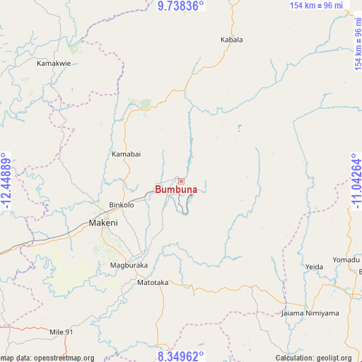
Bumbuna GPS coordinates[2]
9° 2' 40.776" North, 11° 44' 44.736" West
| Map corner | latitude | longitude |
|---|---|---|
| Upper-left | 9.73836°, | -12.44889° |
| Center: | 9.04466°, | -11.74576° |
| Lower-right: | 8.34962°, | -11.04264° |
| Map W x H: | 154.4×154.4 km | = 95.9×95.9mi |
| max Lat: | 9.91376° ⇑9.6% North |
| Bumbuna: | 9.04466° |
| min Lat: | ⇓90.4% South 7.24611° |
| min Long | Bumbuna | max Long |
| -13.28972° | -11.74576° | -10.37135° |
| W 44.6%⇐ | ⇒55.4% E |
Elevation
Elevation of Bumbuna is 127 m = 417 ft, and this is 30.2 m = 99 ft below average elevation for this country.
| Max E: |
564 m = 1850 ft | 43.4% |
| Avg. | 157.2 m = 516 ft | |
| Bumbuna | 127 m = 417 ft | |
Min E: |
1 m = 3 ft | 56.6% |
See also: Sierra Leone elevation on elevation.city.
Geographical zone
Bumbuna is located in North Torrid zone (between Equator and Tropic of Cancer). Distance of Equator is 1005.7 km =624.9 mi to South.| Distance of | km | miles | from Bumbuna |
|---|---|---|---|
| North Pole | 9001.4 | 5593.2 | to North |
| Arctic Circle | 6395.5 | 3974 | to North |
| Tropic Cancer | 1600.2 | 994.3 | to North |
| Equator | 1005.7 | 624.9 | to South |


Nearby cities:
15 places around Bumbuna: (largest is in red/bold)
• Alikalia
41.2 km =25.6 mi,  72°
72°
• Binkolo
27.7 km =17.2 mi,  248°
248°
• Kabala
64.1 km =39.8 mi,  19°
19°
• Kamakwie
74 km =46 mi,  312°
312°
• Kayima
66.7 km =41.4 mi,  105°
105°
• Loma
85.5 km =53.1 mi,  338°
338°
• Magburaka
42.1 km =26.2 mi,  211°
211°
• Makali
47.1 km =29.3 mi,  168°
168°
• Makeni
37.2 km =23.1 mi,  241°
241°
• Masaka
42.7 km =26.5 mi,  188°
188°
• Masingbi
36.9 km =22.9 mi,  217°
217°
• Rokupr
81.6 km =50.7 mi, 239°
• Tefeya
69.8 km =43.4 mi,  122°
122°
• Yengema
73.1 km =45.4 mi, 120°
• Yonibana
86.1 km =53.5 mi, 219°
Sources, notices
• [Note1] Compared only with cities in Sierra Leone existing in our database
• [Src1] Map data: © OpenStreetMap contributors (CC-BY-SA)
• [Src2] Other city data from geonames.org with taken over terms of usage.
• [Src3] Geographical zone / Annual Mean Temperature by Robert A. Rohde @ Wikipedia
