Boajibu geodata
Boajibu (Eastern Province) is a populated place; located in Sierra Leone in Africa/Freetown (GMT+0) time zone. With population of 7,384 people, there are 28 cities with bigger population in this country. Compared to other cities in Sierra Leone, 57.8% of cities are located further ↑North; 65.1% of cities are located further ←West and 62.7% of cities have lower elevation than Boajibu. Note1


Boajibu GPS coordinates[2]
8° 11' 15.468" North, 11° 20' 24.936" West
| Map corner | latitude | longitude |
|---|---|---|
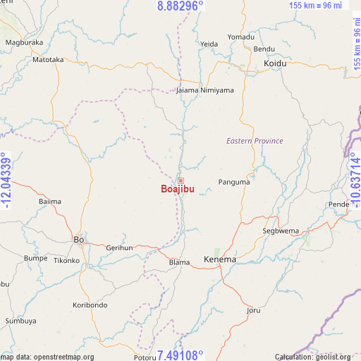
| Upper-left | 8.88296°, | -12.04339° |
| Center: | 8.18763°, | -11.34026° |
| Lower-right: | 7.49108°, | -10.63714° |
| Map W x H: | 154.8×154.8 km | = 96.2×96.2mi |
| max Lat: | 9.91376° ⇑57.8% North |
| Boajibu: | 8.18763° |
| min Lat: | ⇓42.2% South 7.24611° |
| min Long | Boajibu | max Long |
| -13.28972° | -11.34026° | -10.37135° |
| W 65.1%⇐ | ⇒34.9% E |
Elevation
Elevation of Boajibu is 150 m = 492 ft, and this is 7.2 m = 24 ft below average elevation for this country.
| Max E: |
564 m = 1850 ft | 37.3% |
| Avg. | 157.2 m = 516 ft | |
| Boajibu | 150 m = 492 ft | |
Min E: |
1 m = 3 ft | 62.7% |
See also: Sierra Leone elevation on elevation.city.
Geographical zone
Boajibu is located in North Torrid zone (between Equator and Tropic of Cancer). Distance of Equator is 910.4 km =565.7 mi to South.| Distance of | km | miles | from Boajibu |
|---|---|---|---|
| North Pole | 9096.7 | 5652.4 | to North |
| Arctic Circle | 6490.8 | 4033.2 | to North |
| Tropic Cancer | 1695.5 | 1053.5 | to North |
| Equator | 910.4 | 565.7 | to South |


Nearby cities:
15 places around Boajibu: (largest is in red/bold)
• Baiima
56.5 km =35.1 mi,  261°
261°
• Baoma
46.5 km =28.9 mi,  242°
242°
• Barma
18 km =11.2 mi,  3°
3°
• Blama
34.8 km =21.6 mi,  180°
180°
• Bo
50.3 km =31.3 mi, 240°
• Bunumbu
52.4 km =32.6 mi,  91°
91°
• Giehun
46.6 km =29 mi,  136°
136°
• Giehun
52.4 km =32.6 mi,  38°
38°
• Hangha
35.2 km =21.9 mi, 141°
• Kenema
38.3 km =23.8 mi,  154°
154°
• Mamboma
39.9 km =24.8 mi,  253°
253°
• Palima
19.8 km =12.3 mi, 247°
• Panguma
22.8 km =14.2 mi, 90°
• Segbwema
48 km =29.8 mi,  116°
116°
• Wima
19.5 km =12.1 mi,  49°
49°
Sources, notices
• [Note1] Compared only with cities in Sierra Leone existing in our database
• [Src1] Map data: © OpenStreetMap contributors (CC-BY-SA)
• [Src2] Other city data from geonames.org with taken over terms of usage.
• [Src3] Geographical zone / Annual Mean Temperature by Robert A. Rohde @ Wikipedia
