Kodok geodata
Kodok (Fashoda) is a seat of a first-order administrative division; located in South Sudan in Africa/Juba (GMT+2) time zone. In our database, there are 19 cities with bigger population. Compared to other cities in South Sudan, 93.9% of cities are located further ↓South; 72.7% of cities are located further ←West and 97% of cities have higher elevation than Kodok. Note1


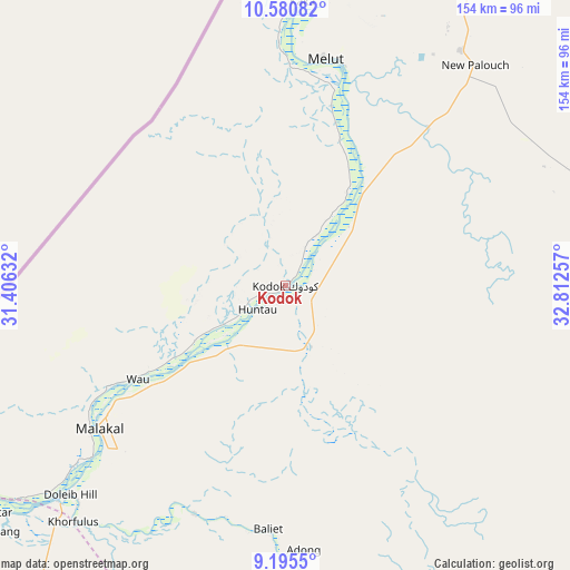
Kodok GPS coordinates[2]
9° 53' 20.004" North, 32° 6' 33.984" East
| Map corner | latitude | longitude |
|---|---|---|
| Upper-left | 10.58082°, | 31.40632° |
| Center: | 9.88889°, | 32.10944° |
| Lower-right: | 9.1955°, | 32.81257° |
| Map W x H: | 154×154 km | = 95.7×95.7mi |
| max Lat: | 11.7431° ⇑6.1% North |
| Kodok: | 9.88889° |
| min Lat: | ⇓93.9% South 3.86512° |
| min Long | Kodok | max Long |
| 25.67833° | 32.10944° | 33.92621° |
| W 72.7%⇐ | ⇒27.3% E |
Elevation
Elevation of Kodok is 394 m = 1293 ft, and this is 94.9 m = 311 ft below average elevation for this country.
| Max E: |
836 m = 2743 ft | 97% |
| Avg. | 488.9 m = 1604 ft | |
| Kodok | 394 m = 1293 ft | |
Min E: |
392 m = 1286 ft | 3% |
See also: South Sudan elevation on elevation.city.
Geographical zone
Kodok is located in North Torrid zone (between Equator and Tropic of Cancer). Distance of Equator is 1099.5 km =683.2 mi to South.| Distance of | km | miles | from Kodok |
|---|---|---|---|
| North Pole | 8907.5 | 5534.9 | to North |
| Arctic Circle | 6301.6 | 3915.6 | to North |
| Tropic Cancer | 1506.4 | 936 | to North |
| Equator | 1099.5 | 683.2 | to South |


Nearby cities:
15 places around Kodok: (largest is in red/bold)
• Akobo
253.1 km =157.3 mi,  157°
157°
• Ayod
211 km =131.1 mi,  201°
201°
• Bentiu
262.9 km =163.4 mi,  254°
254°
• Bor
413.6 km =257 mi,  188°
188°
• Leer
279 km =173.4 mi,  230°
230°
• Maiwut
244.9 km =152.2 mi,  125°
125°
• Malakal
63.1 km =39.2 mi, 231°
• Mayen Abun
421.1 km =261.7 mi,  258°
258°
• Nasir
175.9 km =109.3 mi,  143°
143°
• Pariang
233.1 km =144.8 mi,  270°
270°
• Pibor
361.5 km =224.6 mi, 161°
• Renk
219.7 km =136.5 mi,  20°
20°
• Rumbek
434.8 km =270.2 mi,  217°
217°
• Waat
190.2 km =118.2 mi,  178°
178°
• Yirol
411.2 km =255.5 mi,  205°
205°
Sources, notices
• [Note1] Compared only with cities in South Sudan existing in our database
• [Src1] Map data: © OpenStreetMap contributors (CC-BY-SA)
• [Src2] Other city data from geonames.org with taken over terms of usage.
• [Src3] Geographical zone / Annual Mean Temperature by Robert A. Rohde @ Wikipedia
