Vadanakallu geodata
Vadanakallu (Lac) is a populated place; located in Chad in Africa/Ndjamena (GMT+1) time zone. With population of 1,000 people, there are 44 cities with bigger population in this country. Compared to other cities in Chad, 85.1% of cities are located further ↓South; 97.9% of cities are located further →East and 89.4% of cities have higher elevation than Vadanakallu. Note1


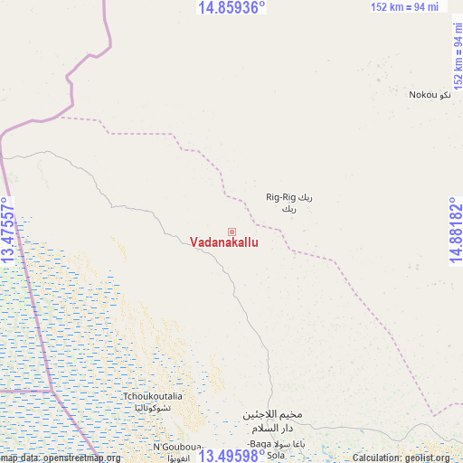
Vadanakallu GPS coordinates[2]
14° 10' 43.284" North, 14° 10' 43.284" East
| Map corner | latitude | longitude |
|---|---|---|
| Upper-left | 14.85936°, | 13.47557° |
| Center: | 14.17869°, | 14.17869° |
| Lower-right: | 13.49598°, | 14.88182° |
| Map W x H: | 151.6×151.6 km | = 94.2×94.2mi |
| max Lat: | 21.8375° ⇑14.9% North |
| Vadanakallu: | 14.17869° |
| min Lat: | ⇓85.1% South 8.26681° |
| min Long | Vadanakallu | max Long |
| 14.1539° | 14.17869° | 22.84308° |
| W 2.1%⇐ | ⇒97.9% E |
Elevation
Elevation of Vadanakallu is 296 m = 971 ft, and this is 141.3 m = 464 ft below average elevation for this country.
| Max E: |
1046 m = 3432 ft | 89.4% |
| Avg. | 437.3 m = 1435 ft | |
| Vadanakallu | 296 m = 971 ft | |
Min E: |
242 m = 794 ft | 10.6% |
See also: Chad elevation on elevation.city.
Geographical zone
Vadanakallu is located in North Torrid zone (between Equator and Tropic of Cancer). Distance of this Northern Tropic circle is 1029.4 km =639.6 mi to North.| Distance of | km | miles | from Vadanakallu |
|---|---|---|---|
| North Pole | 8430.5 | 5238.5 | to North |
| Arctic Circle | 5824.7 | 3619.3 | to North |
| Tropic Cancer | 1029.4 | 639.6 | to North |
| Equator | 1576.5 | 979.6 | to South |


Nearby cities:
11 places around Vadanakallu: (largest is in red/bold)
• Bokoro
370.4 km =230.2 mi,  122°
122°
• Bol
98 km =60.9 mi,  143°
143°
• Dourbali
321 km =199.5 mi,  145°
145°
• Guelendeng
391.9 km =243.5 mi,  157°
157°
• Mao
122.2 km =75.9 mi,  93°
93°
• Massaguet
233.2 km =144.9 mi, 144°
• Massakory
213 km =132.4 mi,  128°
128°
• Massenya
376.6 km =234 mi, 145°
• Moussoro
256.4 km =159.3 mi,  103°
103°
• N'Djamena
248.7 km =154.5 mi, 157°
• Ngama
419.2 km =260.5 mi, 129°
Sources, notices
• [Note1] Compared only with cities in Chad existing in our database
• [Src1] Map data: © OpenStreetMap contributors (CC-BY-SA)
• [Src2] Other city data from geonames.org with taken over terms of usage.
• [Src3] Geographical zone / Annual Mean Temperature by Robert A. Rohde @ Wikipedia
