Guelendeng geodata
Guelendeng (Mayo-Kebbi Est) is a populated place; located in Chad in Africa/Ndjamena (GMT+1) time zone. With population of 11,379 people, there are 32 cities with bigger population in this country. Compared to other cities in Chad, 59.6% of cities are located further ↑North; 78.7% of cities are located further →East and 78.7% of cities have higher elevation than Guelendeng. Note1


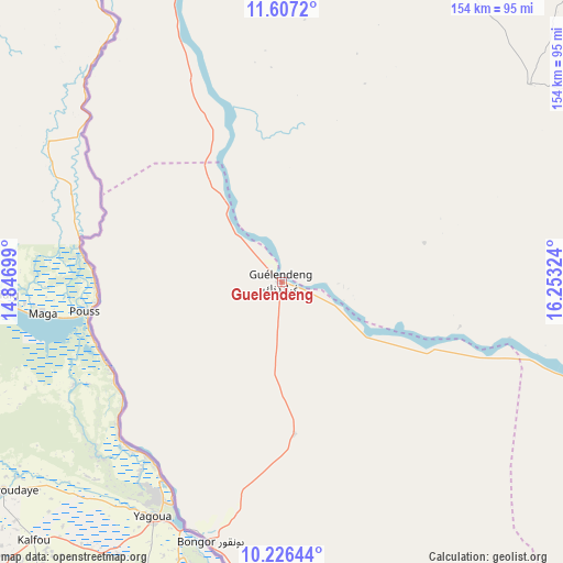
Guelendeng GPS coordinates[2]
10° 55' 3.432" North, 15° 33' 0.396" East
| Map corner | latitude | longitude |
|---|---|---|
| Upper-left | 11.6072°, | 14.84699° |
| Center: | 10.91762°, | 15.55011° |
| Lower-right: | 10.22644°, | 16.25324° |
| Map W x H: | 153.5×153.5 km | = 95.4×95.4mi |
| max Lat: | 21.8375° ⇑59.6% North |
| Guelendeng: | 10.91762° |
| min Lat: | ⇓40.4% South 8.26681° |
| min Long | Guelendeng | max Long |
| 14.1539° | 15.55011° | 22.84308° |
| W 21.3%⇐ | ⇒78.7% E |
Elevation
Elevation of Guelendeng is 321 m = 1053 ft, and this is 116.3 m = 382 ft below average elevation for this country.
| Max E: |
1046 m = 3432 ft | 78.7% |
| Avg. | 437.3 m = 1435 ft | |
| Guelendeng | 321 m = 1053 ft | |
Min E: |
242 m = 794 ft | 21.3% |
See also: Chad elevation on elevation.city.
Geographical zone
Guelendeng is located in North Torrid zone (between Equator and Tropic of Cancer). Distance of Equator is 1213.9 km =754.3 mi to South.| Distance of | km | miles | from Guelendeng |
|---|---|---|---|
| North Pole | 8793.1 | 5463.8 | to North |
| Arctic Circle | 6187.2 | 3844.5 | to North |
| Tropic Cancer | 1392 | 864.9 | to North |
| Equator | 1213.9 | 754.3 | to South |


Nearby cities:
15 places around Guelendeng: (largest is in red/bold)
• Benoy
231 km =143.5 mi,  158°
158°
• Bokoro
231 km =143.5 mi,  45°
45°
• Bongor
73.5 km =45.7 mi,  195°
195°
• Bousso
135.6 km =84.3 mi,  110°
110°
• Béré
189.6 km =117.8 mi, 159°
• Dourbali
104.7 km =65.1 mi,  19°
19°
• Gounou Gaya
143.3 km =89 mi,  181°
181°
• Kelo
181.1 km =112.5 mi,  171°
171°
• Laï
188 km =116.8 mi,  154°
154°
• Massaguet
173.7 km =107.9 mi,  355°
355°
• Massenya
86.6 km =53.8 mi, 51°
• Mboursou Léré
199.4 km =123.9 mi,  229°
229°
• N'Djamena
143.2 km =89 mi,  337°
337°
• Ngama
200.8 km =124.8 mi,  61°
61°
• Pala
186.6 km =115.9 mi, 202°
Sources, notices
• [Note1] Compared only with cities in Chad existing in our database
• [Src1] Map data: © OpenStreetMap contributors (CC-BY-SA)
• [Src2] Other city data from geonames.org with taken over terms of usage.
• [Src3] Geographical zone / Annual Mean Temperature by Robert A. Rohde @ Wikipedia
