Moussoro geodata
Moussoro (Barh el Gazel) is a seat of a first-order administrative division; located in Chad in Africa/Ndjamena (GMT+1) time zone. With population of 15,190 people, there are 23 cities with bigger population in this country. Compared to other cities in Chad, 76.6% of cities are located further ↓South; 59.6% of cities are located further →East and 83% of cities have higher elevation than Moussoro. Note1


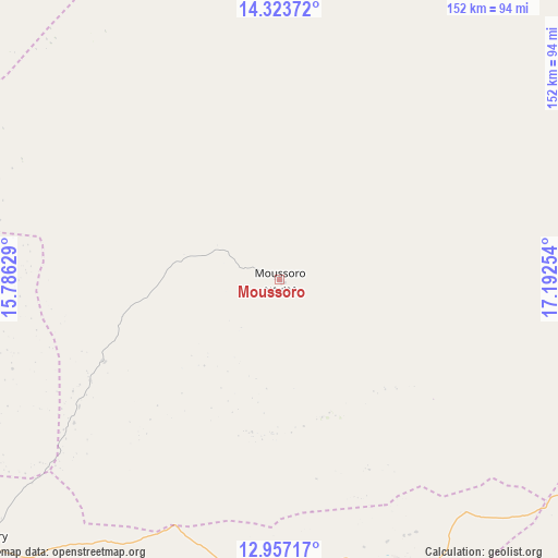
Moussoro GPS coordinates[2]
13° 38' 29.148" North, 16° 29' 21.876" East
| Map corner | latitude | longitude |
|---|---|---|
| Upper-left | 14.32372°, | 15.78629° |
| Center: | 13.64143°, | 16.48941° |
| Lower-right: | 12.95717°, | 17.19254° |
| Map W x H: | 151.9×151.9 km | = 94.4×94.4mi |
| max Lat: | 21.8375° ⇑23.4% North |
| Moussoro: | 13.64143° |
| min Lat: | ⇓76.6% South 8.26681° |
| min Long | Moussoro | max Long |
| 14.1539° | 16.48941° | 22.84308° |
| W 40.4%⇐ | ⇒59.6% E |
Elevation
Elevation of Moussoro is 304 m = 997 ft, and this is 133.3 m = 437 ft below average elevation for this country.
| Max E: |
1046 m = 3432 ft | 83% |
| Avg. | 437.3 m = 1435 ft | |
| Moussoro | 304 m = 997 ft | |
Min E: |
242 m = 794 ft | 17% |
See also: Chad elevation on elevation.city.
Geographical zone
Moussoro is located in North Torrid zone (between Equator and Tropic of Cancer). Distance of this Northern Tropic circle is 1089.1 km =676.7 mi to North.| Distance of | km | miles | from Moussoro |
|---|---|---|---|
| North Pole | 8490.3 | 5275.6 | to North |
| Arctic Circle | 5884.4 | 3656.4 | to North |
| Tropic Cancer | 1089.1 | 676.7 | to North |
| Equator | 1516.8 | 942.5 | to South |


Nearby cities:
15 places around Moussoro: (largest is in red/bold)
• Ati
205.2 km =127.5 mi,  103°
103°
• Bitkine
262.8 km =163.3 mi,  134°
134°
• Bokoro
153.4 km =95.3 mi,  156°
156°
• Bol
192.9 km =119.9 mi,  264°
264°
• Dourbali
214.9 km =133.5 mi,  198°
198°
• Guelendeng
319.6 km =198.6 mi, 198°
• Mao
138 km =85.7 mi,  292°
292°
• Massaguet
172.7 km =107.3 mi,  221°
221°
• Massakory
109.2 km =67.9 mi,  228°
228°
• Massenya
251.2 km =156.1 mi,  187°
187°
• Melfi
327.2 km =203.3 mi,  151°
151°
• Mongo
288.6 km =179.3 mi,  124°
124°
• N'Djamena
231.6 km =143.9 mi, 222°
• Ngama
219.3 km =136.3 mi, 160°
• Vadanakallu
256.4 km =159.3 mi,  283°
283°
Sources, notices
• [Note1] Compared only with cities in Chad existing in our database
• [Src1] Map data: © OpenStreetMap contributors (CC-BY-SA)
• [Src2] Other city data from geonames.org with taken over terms of usage.
• [Src3] Geographical zone / Annual Mean Temperature by Robert A. Rohde @ Wikipedia
