Rŭshon geodata
Rŭshon (Gorno-Badakhshan) is a seat of a second-order administrative division; located in Tajikistan in Asia/Dushanbe (GMT+5) time zone. In our database, there are 65 cities with bigger population. Compared to other cities in Tajikistan, 69.3% of cities are located further ↑North; 96.6% of cities are located further ←West and 93.2% of cities have lower elevation than Rŭshon. Note1


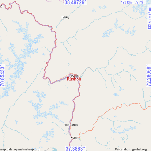
Rŭshon GPS coordinates[2]
37° 56' 41.532" North, 71° 33' 26.82" East
| Map corner | latitude | longitude |
|---|---|---|
| Upper-left | 38.49726°, | 70.85433° |
| Center: | 37.94487°, | 71.55745° |
| Lower-right: | 37.3883°, | 72.26058° |
| Map W x H: | 123.3×123.3 km | = 76.6×76.6mi |
| max Lat: | 40.99827° ⇑69.3% North |
| Rŭshon: | 37.94487° |
| min Lat: | ⇓30.7% South 36.72484° |
| min Long | Rŭshon | max Long |
| 67.60931° | 71.55745° | 73.96674° |
| W 96.6%⇐ | ⇒3.4% E |
Elevation
Elevation of Rŭshon is 1990 m = 6529 ft, and this is 1027.5 m = 3371 ft above average elevation for this country.
| Max E: |
3607 m = 11834 ft | 6.8% |
| Rŭshon | 1990 m 6529 ft | |
| Avg. | 962.5 m = 3158 ft | |
Min E: |
324 m = 1063 ft | 93.2% |
See also: Tajikistan elevation on elevation.city.
Geographical zone
Rŭshon is located in North temperate zone (between Tropic of Cancer and the Arctic Circle). Distance of this Northern Tropic circle is 1613.2 km =1002.4 mi to South.| Distance of | km | miles | from Rŭshon |
|---|---|---|---|
| North Pole | 5788 | 3596.5 | to North |
| Arctic Circle | 3182.1 | 1977.3 | to North |
| Tropic Cancer | 1613.2 | 1002.4 | to South |
| Equator | 4219.1 | 2621.6 | to South |


Nearby cities:
15 places around Rŭshon: (largest is in red/bold)
• Chubek
166.9 km =103.7 mi,  257°
257°
• Ishqoshim
135.7 km =84.3 mi,  177°
177°
• Jirghatol
145.3 km =90.3 mi,  347°
347°
• Karakenja
143.6 km =89.2 mi,  358°
358°
• Khorugh
50.6 km =31.4 mi, 180°
• Khovaling
145.2 km =90.2 mi,  287°
287°
• Kŭlob
155.5 km =96.6 mi,  268°
268°
• Mŭ’minobod
134.8 km =83.8 mi,  277°
277°
• Qalaikhumb
87.8 km =54.6 mi,  310°
310°
• Rasht
158.5 km =98.5 mi,  319°
319°
• Roshtqal’a
79.9 km =49.6 mi,  162°
162°
• Shŭrobod
132.9 km =82.6 mi, 265°
• Tajikobod
145.2 km =90.2 mi,  334°
334°
• Tavildara
125.4 km =77.9 mi, 311°
• Vanj
48.2 km =30 mi, 349°
Sources, notices
• [Note1] Compared only with cities in Tajikistan existing in our database
• [Src1] Map data: © OpenStreetMap contributors (CC-BY-SA)
• [Src2] Other city data from geonames.org with taken over terms of usage.
• [Src3] Geographical zone / Annual Mean Temperature by Robert A. Rohde @ Wikipedia
