Ayní geodata
Ayní (Sughd) is a seat of a second-order administrative division; located in Tajikistan in Asia/Dushanbe (GMT+5) time zone. With population of 2,128 people, there are 62 cities with bigger population in this country. Compared to other cities in Tajikistan, 69.3% of cities are located further ↓South; 88.6% of cities are located further →East and 79.5% of cities have lower elevation than Ayní. Note1


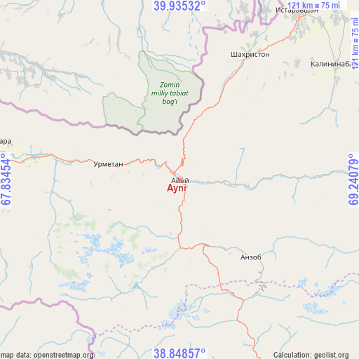
Ayní GPS coordinates[2]
39° 23' 38.616" North, 68° 32' 15.576" East
| Map corner | latitude | longitude |
|---|---|---|
| Upper-left | 39.93532°, | 67.83454° |
| Center: | 39.39406°, | 68.53766° |
| Lower-right: | 38.84857°, | 69.24079° |
| Map W x H: | 120.8×120.8 km | = 75.1×75.1mi |
| max Lat: | 40.99827° ⇑30.7% North |
| Ayní: | 39.39406° |
| min Lat: | ⇓69.3% South 36.72484° |
| min Long | Ayní | max Long |
| 67.60931° | 68.53766° | 73.96674° |
| W 11.4%⇐ | ⇒88.6% E |
Elevation
Elevation of Ayní is 1433 m = 4701 ft, and this is 470.5 m = 1544 ft above average elevation for this country.
| Max E: |
3607 m = 11834 ft | 20.5% |
| Ayní | 1433 m 4701 ft | |
| Avg. | 962.5 m = 3158 ft | |
Min E: |
324 m = 1063 ft | 79.5% |
See also: Tajikistan elevation on elevation.city.
Geographical zone
Ayní is located in North temperate zone (between Tropic of Cancer and the Arctic Circle). Distance of this Northern Tropic circle is 1774.3 km =1102.5 mi to South.| Distance of | km | miles | from Ayní |
|---|---|---|---|
| North Pole | 5626.9 | 3496.4 | to North |
| Arctic Circle | 3021 | 1877.2 | to North |
| Tropic Cancer | 1774.3 | 1102.5 | to South |
| Equator | 4380.2 | 2721.7 | to South |


Nearby cities:
15 places around Ayní: (largest is in red/bold)
• Dushanbe
97.7 km =60.7 mi,  167°
167°
• Ghonchí
81 km =50.3 mi,  38°
38°
• Hisor
96.6 km =60 mi,  179°
179°
• Istaravshan
70.2 km =43.6 mi,  34°
34°
• Khodzha-Maston
72.6 km =45.1 mi, 173°
• Mehron
64.4 km =40 mi,  87°
87°
• Pakhtakoron
86.7 km =53.9 mi,  11°
11°
• Panjakent
80.5 km =50 mi,  278°
278°
• Shahrinav
93.2 km =57.9 mi,  190°
190°
• Shahriston
48.3 km =30 mi, 28°
• Tagob
69.2 km =43 mi,  153°
153°
• Tursunzoda
101.5 km =63.1 mi,  195°
195°
• Vahdat
101.8 km =63.3 mi,  156°
156°
• Varzob
73.1 km =45.4 mi, 160°
• Zafarobod
90.9 km =56.5 mi,  16°
16°
Sources, notices
• [Note1] Compared only with cities in Tajikistan existing in our database
• [Src1] Map data: © OpenStreetMap contributors (CC-BY-SA)
• [Src2] Other city data from geonames.org with taken over terms of usage.
• [Src3] Geographical zone / Annual Mean Temperature by Robert A. Rohde @ Wikipedia
