Pakhtakoron geodata
Pakhtakoron (Sughd) is a populated place; located in Tajikistan in Asia/Dushanbe (GMT+5) time zone. With population of 8,220 people, there are 40 cities with bigger population in this country. Compared to other cities in Tajikistan, 80.7% of cities are located further ↓South; 80.7% of cities are located further →East and 88.6% of cities have higher elevation than Pakhtakoron. Note1


Pakhtakoron GPS coordinates[2]
40° 9' 25.524" North, 68° 44' 47.724" East
| Map corner | latitude | longitude |
|---|---|---|
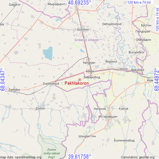
| Upper-left | 40.69235°, | 68.04347° |
| Center: | 40.15709°, | 68.74659° |
| Lower-right: | 39.61758°, | 69.44972° |
| Map W x H: | 119.5×119.5 km | = 74.3×74.3mi |
| max Lat: | 40.99827° ⇑19.3% North |
| Pakhtakoron: | 40.15709° |
| min Lat: | ⇓80.7% South 36.72484° |
| min Long | Pakhtakoron | max Long |
| 67.60931° | 68.74659° | 73.96674° |
| W 19.3%⇐ | ⇒80.7% E |
Elevation
Elevation of Pakhtakoron is 387 m = 1270 ft, and this is 575.5 m = 1888 ft below average elevation for this country.
| Max E: |
3607 m = 11834 ft | 88.6% |
| Avg. | 962.5 m = 3158 ft | |
| Pakhtakoron | 387 m = 1270 ft | |
Min E: |
324 m = 1063 ft | 11.4% |
See also: Tajikistan elevation on elevation.city.
Geographical zone
Pakhtakoron is located in North temperate zone (between Tropic of Cancer and the Arctic Circle). Distance of this Northern Tropic circle is 1859.1 km =1155.2 mi to South.| Distance of | km | miles | from Pakhtakoron |
|---|---|---|---|
| North Pole | 5542 | 3443.6 | to North |
| Arctic Circle | 2936.1 | 1824.4 | to North |
| Tropic Cancer | 1859.1 | 1155.2 | to South |
| Equator | 4465 | 2774.4 | to South |


Nearby cities:
15 places around Pakhtakoron: (largest is in red/bold)
• Ayní
86.7 km =53.9 mi,  191°
191°
• Bŭston
64.2 km =39.9 mi,  50°
50°
• Chkalov
81 km =50.3 mi,  83°
83°
• Ghafurov
83.7 km =52 mi,  85°
85°
• Ghonchí
39.1 km =24.3 mi,  123°
123°
• Istaravshan
34.7 km =21.6 mi,  141°
141°
• Khŭjand
75.6 km =47 mi, 79°
• Konsoy
89.2 km =55.4 mi,  65°
65°
• Nov
53 km =32.9 mi, 90°
• Palos
85.9 km =53.4 mi, 78°
• Proletar
64.2 km =39.9 mi, 89°
• Quruqsoy
71.1 km =44.2 mi, 48°
• Shahriston
42.9 km =26.7 mi,  172°
172°
• Taboshar
88.7 km =55.1 mi,  58°
58°
• Zafarobod
8.8 km =5.5 mi, 76°
Sources, notices
• [Note1] Compared only with cities in Tajikistan existing in our database
• [Src1] Map data: © OpenStreetMap contributors (CC-BY-SA)
• [Src2] Other city data from geonames.org with taken over terms of usage.
• [Src3] Geographical zone / Annual Mean Temperature by Robert A. Rohde @ Wikipedia
