Khodzha-Maston geodata
Khodzha-Maston (Republican Subordination) is a populated place; located in Tajikistan in Asia/Dushanbe (GMT+5) time zone. With population of 9,781 people, there are 36 cities with bigger population in this country. Compared to other cities in Tajikistan, 58% of cities are located further ↓South; 85.2% of cities are located further →East and 85.2% of cities have lower elevation than Khodzha-Maston. Note1


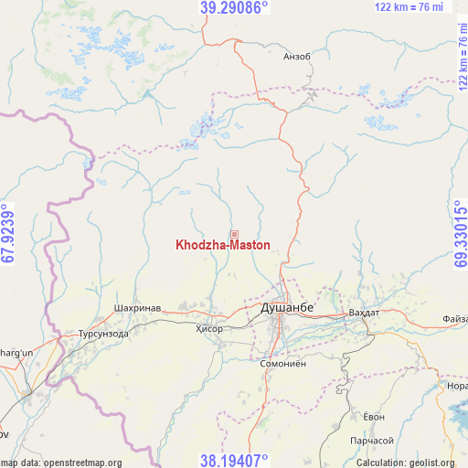
Khodzha-Maston GPS coordinates[2]
38° 44' 40.452" North, 68° 37' 37.272" East
| Map corner | latitude | longitude |
|---|---|---|
| Upper-left | 39.29086°, | 67.9239° |
| Center: | 38.74457°, | 68.62702° |
| Lower-right: | 38.19407°, | 69.33015° |
| Map W x H: | 122×122 km | = 75.8×75.8mi |
| max Lat: | 40.99827° ⇑42% North |
| Khodzha-Maston: | 38.74457° |
| min Lat: | ⇓58% South 36.72484° |
| min Long | Khodzha-Maston | max Long |
| 67.60931° | 68.62702° | 73.96674° |
| W 14.8%⇐ | ⇒85.2% E |
Elevation
Elevation of Khodzha-Maston is 1565 m = 5135 ft, and this is 602.5 m = 1977 ft above average elevation for this country.
| Max E: |
3607 m = 11834 ft | 14.8% |
| Khodzha-Maston | 1565 m 5135 ft | |
| Avg. | 962.5 m = 3158 ft | |
Min E: |
324 m = 1063 ft | 85.2% |
See also: Tajikistan elevation on elevation.city.
Geographical zone
Khodzha-Maston is located in North temperate zone (between Tropic of Cancer and the Arctic Circle). Distance of this Northern Tropic circle is 1702.1 km =1057.6 mi to South.| Distance of | km | miles | from Khodzha-Maston |
|---|---|---|---|
| North Pole | 5699.1 | 3541.3 | to North |
| Arctic Circle | 3093.2 | 1922 | to North |
| Tropic Cancer | 1702.1 | 1057.6 | to South |
| Equator | 4308 | 2676.9 | to South |


Nearby cities:
15 places around Khodzha-Maston: (largest is in red/bold)
• Abdurahmoni Jomí
90.2 km =56 mi,  169°
169°
• Ayní
72.6 km =45.1 mi,  353°
353°
• Boshkengash
34.6 km =21.5 mi,  153°
153°
• Dushanbe
26.7 km =16.6 mi, 150°
• Fayzobod
64 km =39.8 mi,  110°
110°
• Hisor
25.3 km =15.7 mi,  195°
195°
• Norak
72.2 km =44.9 mi,  123°
123°
• Obikiik
65.1 km =40.5 mi,  177°
177°
• Shahrinav
31.9 km =19.8 mi,  232°
232°
• Somoniyon
36 km =22.4 mi,  159°
159°
• Tagob
25.7 km =16 mi,  66°
66°
• Tursunzoda
42.9 km =26.7 mi, 233°
• Vahdat
39.6 km =24.6 mi, 121°
• Varzob
16.9 km =10.5 mi,  78°
78°
• Yovon
59.7 km =37.1 mi,  143°
143°
Sources, notices
• [Note1] Compared only with cities in Tajikistan existing in our database
• [Src1] Map data: © OpenStreetMap contributors (CC-BY-SA)
• [Src2] Other city data from geonames.org with taken over terms of usage.
• [Src3] Geographical zone / Annual Mean Temperature by Robert A. Rohde @ Wikipedia
