Tajerouine geodata
Tajerouine (Kef) is a populated place; located in Tunisia in Africa/Tunis (GMT+1) time zone. With population of 18,909 people, there are 59 cities with bigger population in this country. Compared to other cities in Tunisia, 52.4% of cities are located further ↓South; 93% of cities are located further →East and 95.8% of cities have lower elevation than Tajerouine. Note1


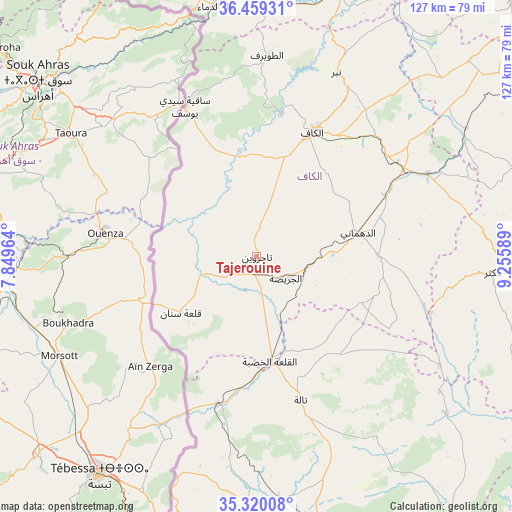
Tajerouine GPS coordinates[2]
35° 53' 30.264" North, 8° 33' 9.936" East
| Map corner | latitude | longitude |
|---|---|---|
| Upper-left | 36.45931°, | 7.84964° |
| Center: | 35.89174°, | 8.55276° |
| Lower-right: | 35.32008°, | 9.25589° |
| Map W x H: | 126.7×126.7 km | = 78.7×78.7mi |
| max Lat: | 37.27442° ⇑47.6% North |
| Tajerouine: | 35.89174° |
| min Lat: | ⇓52.4% South 32.31662° |
| min Long | Tajerouine | max Long |
| 7.87765° | 8.55276° | 11.21965° |
| W 7%⇐ | ⇒93% E |
Elevation
Elevation of Tajerouine is 660 m = 2165 ft, and this is 510.6 m = 1675 ft above average elevation for this country.
| Max E: |
999 m = 3278 ft | 4.2% |
| Tajerouine | 660 m 2165 ft | |
| Avg. | 149.4 m = 490 ft | |
Min E: |
-6 m = -20 ft | 95.8% |
See also: Tunisia elevation on elevation.city.
Geographical zone
Tajerouine is located in North temperate zone (between Tropic of Cancer and the Arctic Circle). Distance of this Northern Tropic circle is 1384.9 km =860.5 mi to South.| Distance of | km | miles | from Tajerouine |
|---|---|---|---|
| North Pole | 6016.3 | 3738.4 | to North |
| Arctic Circle | 3410.4 | 2119.1 | to North |
| Tropic Cancer | 1384.9 | 860.5 | to South |
| Equator | 3990.8 | 2479.8 | to South |


Nearby cities:
15 places around Tajerouine: (largest is in red/bold)
• As Sars
46.9 km =29.1 mi,  64°
64°
• El Kef
34.3 km =21.3 mi,  23°
23°
• El Ksour
29.9 km =18.6 mi,  89°
89°
• Jendouba
70.8 km =44 mi, 16°
• Kesra
73.7 km =45.8 mi,  96°
96°
• Le Krib
71.4 km =44.4 mi,  47°
47°
• Maktar
58.5 km =36.4 mi, 93°
• Menzel Salem
7.9 km =4.9 mi,  240°
240°
• Nibbar
48.7 km =30.3 mi, 23°
• Oued Meliz
64.1 km =39.8 mi,  359°
359°
• Rohia
52.5 km =32.6 mi,  120°
120°
• Sakiet Sidi Youssef
40.9 km =25.4 mi,  334°
334°
• Sbiba
60.9 km =37.8 mi,  129°
129°
• Siliana
76.7 km =47.7 mi,  73°
73°
• Thala
37.1 km =23.1 mi,  163°
163°
Sources, notices
• [Note1] Compared only with cities in Tunisia existing in our database
• [Src1] Map data: © OpenStreetMap contributors (CC-BY-SA)
• [Src2] Other city data from geonames.org with taken over terms of usage.
• [Src3] Geographical zone / Annual Mean Temperature by Robert A. Rohde @ Wikipedia
