Sakiet Sidi Youssef geodata
Sakiet Sidi Youssef (Kef) is a populated place; located in Tunisia in Africa/Tunis (GMT+1) time zone. With population of 6,442 people, there are 106 cities with bigger population in this country. Compared to other cities in Tunisia, 58.7% of cities are located further ↓South; 95.8% of cities are located further →East and 97.9% of cities have lower elevation than Sakiet Sidi Youssef. Note1


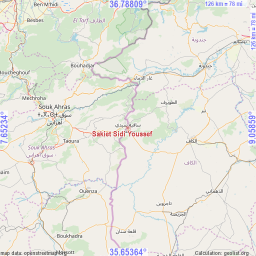
Sakiet Sidi Youssef GPS coordinates[2]
36° 13' 22.512" North, 8° 21' 19.692" East
| Map corner | latitude | longitude |
|---|---|---|
| Upper-left | 36.78809°, | 7.65234° |
| Center: | 36.22292°, | 8.35547° |
| Lower-right: | 35.65364°, | 9.05859° |
| Map W x H: | 126.1×126.1 km | = 78.4×78.4mi |
| max Lat: | 37.27442° ⇑41.3% North |
| Sakiet Sidi Youssef: | 36.22292° |
| min Lat: | ⇓58.7% South 32.31662° |
| min Long | Sakiet Sidi You | max Long |
| 7.87765° | 8.35547° | 11.21965° |
| W 4.2%⇐ | ⇒95.8% E |
Elevation
Elevation of Sakiet Sidi Youssef is 808 m = 2651 ft, and this is 658.6 m = 2161 ft above average elevation for this country.
| Max E: |
999 m = 3278 ft | 2.1% |
| Sakiet Sidi Youssef | 808 m 2651 ft | |
| Avg. | 149.4 m = 490 ft | |
Min E: |
-6 m = -20 ft | 97.9% |
See also: Tunisia elevation on elevation.city.
Geographical zone
Sakiet Sidi Youssef is located in North temperate zone (between Tropic of Cancer and the Arctic Circle). Distance of this Northern Tropic circle is 1421.7 km =883.4 mi to South.| Distance of | km | miles | from Sakiet Sidi Youssef |
|---|---|---|---|
| North Pole | 5979.5 | 3715.5 | to North |
| Arctic Circle | 3373.6 | 2096.3 | to North |
| Tropic Cancer | 1421.7 | 883.4 | to South |
| Equator | 4027.6 | 2502.6 | to South |


Nearby cities:
15 places around Sakiet Sidi Youssef: (largest is in red/bold)
• As Sars
61.9 km =38.5 mi,  105°
105°
• El Kef
31.8 km =19.8 mi,  99°
99°
• El Ksour
59.9 km =37.2 mi,  127°
127°
• Fernana
56.9 km =35.4 mi,  32°
32°
• Gafour
87.5 km =54.4 mi,  82°
82°
• Jendouba
49 km =30.4 mi,  50°
50°
• Le Krib
70.9 km =44.1 mi, 80°
• Maktar
86.1 km =53.5 mi,  118°
118°
• Menzel Salem
42.1 km =26.2 mi,  165°
165°
• Nibbar
37.7 km =23.4 mi, 77°
• Oued Meliz
32.3 km =20.1 mi, 32°
• Tabarka
88.9 km =55.2 mi,  23°
23°
• Tabursuq
84 km =52.2 mi,  71°
71°
• Tajerouine
40.9 km =25.4 mi,  154°
154°
• Thala
77.7 km =48.3 mi,  158°
158°
Sources, notices
• [Note1] Compared only with cities in Tunisia existing in our database
• [Src1] Map data: © OpenStreetMap contributors (CC-BY-SA)
• [Src2] Other city data from geonames.org with taken over terms of usage.
• [Src3] Geographical zone / Annual Mean Temperature by Robert A. Rohde @ Wikipedia
