Gafour geodata
Gafour (Silyānah) is a populated place; located in Tunisia in Africa/Tunis (GMT+1) time zone. With population of 10,556 people, there are 85 cities with bigger population in this country. Compared to other cities in Tunisia, 60.1% of cities are located further ↓South; 76.2% of cities are located further →East and 80.4% of cities have lower elevation than Gafour. Note1


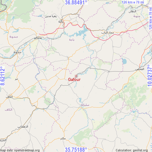
Gafour GPS coordinates[2]
36° 19' 13.62" North, 9° 19' 27.264" East
| Map corner | latitude | longitude |
|---|---|---|
| Upper-left | 36.88491°, | 8.62112° |
| Center: | 36.32045°, | 9.32424° |
| Lower-right: | 35.75188°, | 10.02737° |
| Map W x H: | 126×126 km | = 78.3×78.3mi |
| max Lat: | 37.27442° ⇑39.9% North |
| Gafour: | 36.32045° |
| min Lat: | ⇓60.1% South 32.31662° |
| min Long | Gafour | max Long |
| 7.87765° | 9.32424° | 11.21965° |
| W 23.8%⇐ | ⇒76.2% E |
Elevation
Elevation of Gafour is 268 m = 879 ft, and this is 118.6 m = 389 ft above average elevation for this country.
| Max E: |
999 m = 3278 ft | 19.6% |
| Gafour | 268 m 879 ft | |
| Avg. | 149.4 m = 490 ft | |
Min E: |
-6 m = -20 ft | 80.4% |
See also: Tunisia elevation on elevation.city.
Geographical zone
Gafour is located in North temperate zone (between Tropic of Cancer and the Arctic Circle). Distance of this Northern Tropic circle is 1432.5 km =890.1 mi to South.| Distance of | km | miles | from Gafour |
|---|---|---|---|
| North Pole | 5968.6 | 3708.7 | to North |
| Arctic Circle | 3362.7 | 2089.5 | to North |
| Tropic Cancer | 1432.5 | 890.1 | to South |
| Equator | 4038.5 | 2509.4 | to South |


Nearby cities:
15 places around Gafour: (largest is in red/bold)
• As Sars
38.4 km =23.9 mi,  225°
225°
• Bou Arada
26.9 km =16.7 mi,  82°
82°
• Béja
46.8 km =29.1 mi,  344°
344°
• El Fahs
52.5 km =32.6 mi, 83°
• El Kef
57.9 km =36 mi,  253°
253°
• Goubellat
39.1 km =24.3 mi,  50°
50°
• Jendouba
52.7 km =32.7 mi,  292°
292°
• Kesra
56.5 km =35.1 mi,  176°
176°
• Le Krib
16.9 km =10.5 mi,  272°
272°
• Maktar
52.6 km =32.7 mi,  192°
192°
• Medjez el Bab
44.8 km =27.8 mi,  35°
35°
• Nibbar
50.1 km =31.1 mi, 266°
• Siliana
26.5 km =16.5 mi,  170°
170°
• Tabursuq
16.7 km =10.4 mi, 335°
• Testour
27.8 km =17.3 mi,  22°
22°
Sources, notices
• [Note1] Compared only with cities in Tunisia existing in our database
• [Src1] Map data: © OpenStreetMap contributors (CC-BY-SA)
• [Src2] Other city data from geonames.org with taken over terms of usage.
• [Src3] Geographical zone / Annual Mean Temperature by Robert A. Rohde @ Wikipedia
