Jilma geodata
Jilma (Sīdī Bū Zayd) is a populated place; located in Tunisia in Africa/Tunis (GMT+1) time zone. With population of 5,647 people, there are 114 cities with bigger population in this country. Compared to other cities in Tunisia, 73.4% of cities are located further ↑North; 74.1% of cities are located further →East and 85.3% of cities have lower elevation than Jilma. Note1


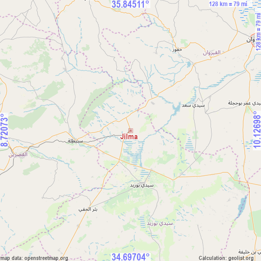
Jilma GPS coordinates[2]
35° 16' 23.196" North, 9° 25' 25.86" East
| Map corner | latitude | longitude |
|---|---|---|
| Upper-left | 35.84511°, | 8.72073° |
| Center: | 35.27311°, | 9.42385° |
| Lower-right: | 34.69704°, | 10.12698° |
| Map W x H: | 127.7×127.7 km | = 79.3×79.3mi |
| max Lat: | 37.27442° ⇑73.4% North |
| Jilma: | 35.27311° |
| min Lat: | ⇓26.6% South 32.31662° |
| min Long | Jilma | max Long |
| 7.87765° | 9.42385° | 11.21965° |
| W 25.9%⇐ | ⇒74.1% E |
Elevation
Elevation of Jilma is 364 m = 1194 ft, and this is 214.6 m = 704 ft above average elevation for this country.
| Max E: |
999 m = 3278 ft | 14.7% |
| Jilma | 364 m 1194 ft | |
| Avg. | 149.4 m = 490 ft | |
Min E: |
-6 m = -20 ft | 85.3% |
See also: Tunisia elevation on elevation.city.
Geographical zone
Jilma is located in North temperate zone (between Tropic of Cancer and the Arctic Circle). Distance of this Northern Tropic circle is 1316.1 km =817.8 mi to South.| Distance of | km | miles | from Jilma |
|---|---|---|---|
| North Pole | 6085.1 | 3781.1 | to North |
| Arctic Circle | 3479.2 | 2161.9 | to North |
| Tropic Cancer | 1316.1 | 817.8 | to South |
| Equator | 3922 | 2437 | to South |


Nearby cities:
15 places around Jilma: (largest is in red/bold)
• Bir Ali Ben Khalifa
85.3 km =53 mi,  134°
134°
• Bir el Hafey
43.3 km =26.9 mi,  208°
208°
• Chorbane
87.3 km =54.2 mi,  89°
89°
• El Ksour
84.7 km =52.6 mi,  324°
324°
• Er Regueb
56.6 km =35.2 mi,  144°
144°
• Haffouz
46 km =28.6 mi,  29°
29°
• Kairouan
75.7 km =47 mi,  53°
53°
• Kasserine
54.6 km =33.9 mi,  257°
257°
• Kesra
60.3 km =37.5 mi,  354°
354°
• Maktar
68.1 km =42.3 mi,  342°
342°
• Mezzouna
86.2 km =53.6 mi,  153°
153°
• Rohia
53.8 km =33.4 mi, 321°
• Sbiba
43.7 km =27.2 mi,  313°
313°
• Sidi Bouzid
26.7 km =16.6 mi,  167°
167°
• Thala
76 km =47.2 mi,  295°
295°
Sources, notices
• [Note1] Compared only with cities in Tunisia existing in our database
• [Src1] Map data: © OpenStreetMap contributors (CC-BY-SA)
• [Src2] Other city data from geonames.org with taken over terms of usage.
• [Src3] Geographical zone / Annual Mean Temperature by Robert A. Rohde @ Wikipedia
