Ermenek geodata
Ermenek (Karaman) is a seat of a second-order administrative division; located in Turkey in Europe/Istanbul (GMT+3) time zone. With population of 16,986 people, there are 366 cities with bigger population in this country. Compared to other cities in Turkey, 96% of cities are located further ↑North; 62.6% of cities are located further →East and 85.1% of cities have lower elevation than Ermenek. Note1


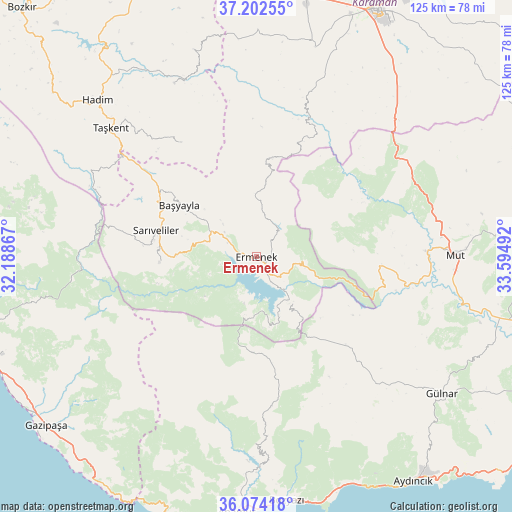
Ermenek GPS coordinates[2]
36° 38' 25.548" North, 32° 53' 30.444" East
| Map corner | latitude | longitude |
|---|---|---|
| Upper-left | 37.20255°, | 32.18867° |
| Center: | 36.64043°, | 32.89179° |
| Lower-right: | 36.07418°, | 33.59492° |
| Map W x H: | 125.5×125.5 km | = 78×78mi |
| max Lat: | 42.02683° ⇑96% North |
| Ermenek: | 36.64043° |
| min Lat: | ⇓4% South 35.9025° |
| min Long | Ermenek | max Long |
| 25.90902° | 32.89179° | 44.60099° |
| W 37.4%⇐ | ⇒62.6% E |
Elevation
Elevation of Ermenek is 1312 m = 4304 ft, and this is 594.6 m = 1951 ft above average elevation for this country.
| Max E: |
2682 m = 8799 ft | 14.9% |
| Ermenek | 1312 m 4304 ft | |
| Avg. | 717.4 m = 2354 ft | |
Min E: |
0 m = 0 ft | 85.1% |
See also: Turkey elevation on elevation.city.
Geographical zone
Ermenek is located in North temperate zone (between Tropic of Cancer and the Arctic Circle). Distance of this Northern Tropic circle is 1468.1 km =912.2 mi to South.| Distance of | km | miles | from Ermenek |
|---|---|---|---|
| North Pole | 5933 | 3686.6 | to North |
| Arctic Circle | 3327.1 | 2067.4 | to North |
| Tropic Cancer | 1468.1 | 912.2 | to South |
| Equator | 4074 | 2531.5 | to South |


Nearby cities:
15 places around Ermenek: (largest is in red/bold)
• Anamur
63.1 km =39.2 mi,  184°
184°
• Başyayla
22.7 km =14.1 mi,  303°
303°
• Bozyazı
59.5 km =37 mi,  174°
174°
• Bucakkışla
36.8 km =22.9 mi,  18°
18°
• Gazipaşa
65.8 km =40.9 mi,  231°
231°
• Göktepe
24 km =14.9 mi,  266°
266°
• Gülnar
56.2 km =34.9 mi,  126°
126°
• Hadim
54.7 km =34 mi,  314°
314°
• Kazancı
15.6 km =9.7 mi,  190°
190°
• Kazımkarabekir
65.9 km =40.9 mi,  5°
5°
• Köprülü
63.8 km =39.6 mi,  279°
279°
• Mut
48.8 km =30.3 mi,  89°
89°
• Sarıveliler
25.7 km =16 mi, 284°
• Taşkent
47.6 km =29.6 mi, 311°
• Tepebaşı
15.4 km =9.6 mi, 280°
Sources, notices
• [Note1] Compared only with cities in Turkey existing in our database
• [Src1] Map data: © OpenStreetMap contributors (CC-BY-SA)
• [Src2] Other city data from geonames.org with taken over terms of usage.
• [Src3] Geographical zone / Annual Mean Temperature by Robert A. Rohde @ Wikipedia
