Sürgü geodata
Sürgü (Malatya) is a seat of a third-order administrative division; located in Turkey in Europe/Istanbul (GMT+3) time zone. In our database, there are 1323 cities with bigger population. Compared to other cities in Turkey, 61.3% of cities are located further ↑North; 61.4% of cities are located further ←West and 85.4% of cities have lower elevation than Sürgü. Note1


Sürgü GPS coordinates[2]
38° 0' 19.728" North, 37° 57' 48.6" East
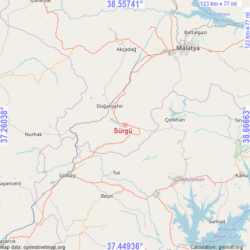
| Map corner | latitude | longitude |
|---|---|---|
| Upper-left | 38.55741°, | 37.26038° |
| Center: | 38.00548°, | 37.9635° |
| Lower-right: | 37.44936°, | 38.66663° |
| Map W x H: | 123.2×123.2 km | = 76.6×76.6mi |
| max Lat: | 42.02683° ⇑61.3% North |
| Sürgü: | 38.00548° |
| min Lat: | ⇓38.7% South 35.9025° |
| min Long | Sürgü | max Long |
| 25.90902° | 37.9635° | 44.60099° |
| W 61.4%⇐ | ⇒38.6% E |
Elevation
Elevation of Sürgü is 1318 m = 4324 ft, and this is 600.6 m = 1970 ft above average elevation for this country.
| Max E: |
2682 m = 8799 ft | 14.6% |
| Sürgü | 1318 m 4324 ft | |
| Avg. | 717.4 m = 2354 ft | |
Min E: |
0 m = 0 ft | 85.4% |
See also: Turkey elevation on elevation.city.
Geographical zone
Sürgü is located in North temperate zone (between Tropic of Cancer and the Arctic Circle). Distance of this Northern Tropic circle is 1619.9 km =1006.6 mi to South.| Distance of | km | miles | from Sürgü |
|---|---|---|---|
| North Pole | 5781.2 | 3592.3 | to North |
| Arctic Circle | 3175.4 | 1973.1 | to North |
| Tropic Cancer | 1619.9 | 1006.6 | to South |
| Equator | 4225.8 | 2625.8 | to South |


Nearby cities:
15 places around Sürgü: (largest is in red/bold)
• Adıyaman
38.4 km =23.9 mi,  134°
134°
• Akçadağ
37.1 km =23.1 mi,  0°
0°
• Besni
35.9 km =22.3 mi,  194°
194°
• Doğanşehir
12 km =7.5 mi,  317°
317°
• Gölbaşı
37.8 km =23.5 mi,  229°
229°
• Gücük
47.1 km =29.3 mi,  296°
296°
• Harmanlı
26.8 km =16.7 mi, 225°
• Koçali
27.4 km =17 mi,  109°
109°
• Kuyucak
36.9 km =22.9 mi,  115°
115°
• Kürecik
41.6 km =25.8 mi,  332°
332°
• Nurhak
46.1 km =28.6 mi,  264°
264°
• Tut
23.7 km =14.7 mi, 190°
• Yeşilyurt
40.6 km =25.2 mi,  37°
37°
• Çelikhan
24 km =14.9 mi,  84°
84°
• Şambayat
36.4 km =22.6 mi,  168°
168°
Sources, notices
• [Note1] Compared only with cities in Turkey existing in our database
• [Src1] Map data: © OpenStreetMap contributors (CC-BY-SA)
• [Src2] Other city data from geonames.org with taken over terms of usage.
• [Src3] Geographical zone / Annual Mean Temperature by Robert A. Rohde @ Wikipedia
