Sarıyahşi geodata
Sarıyahşi (Aksaray) is a seat of a second-order administrative division; located in Turkey in Europe/Istanbul (GMT+3) time zone. With population of 8,704 people, there are 544 cities with bigger population in this country. Compared to other cities in Turkey, 54.2% of cities are located further ↓South; 58.9% of cities are located further →East and 65.7% of cities have lower elevation than Sarıyahşi. Note1


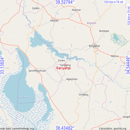
Sarıyahşi GPS coordinates[2]
38° 59' 0.564" North, 33° 50' 28.896" East
| Map corner | latitude | longitude |
|---|---|---|
| Upper-left | 39.52794°, | 33.13824° |
| Center: | 38.98349°, | 33.84136° |
| Lower-right: | 38.43482°, | 34.54449° |
| Map W x H: | 121.5×121.5 km | = 75.5×75.5mi |
| max Lat: | 42.02683° ⇑45.8% North |
| Sarıyahşi: | 38.98349° |
| min Lat: | ⇓54.2% South 35.9025° |
| min Long | Sarıyahşi | max Long |
| 25.90902° | 33.84136° | 44.60099° |
| W 41.1%⇐ | ⇒58.9% E |
Elevation
Elevation of Sarıyahşi is 971 m = 3186 ft, and this is 253.6 m = 832 ft above average elevation for this country.
| Max E: |
2682 m = 8799 ft | 34.3% |
| Sarıyahşi | 971 m 3186 ft | |
| Avg. | 717.4 m = 2354 ft | |
Min E: |
0 m = 0 ft | 65.7% |
See also: Turkey elevation on elevation.city.
Geographical zone
Sarıyahşi is located in North temperate zone (between Tropic of Cancer and the Arctic Circle). Distance of this Northern Tropic circle is 1728.6 km =1074.1 mi to South.| Distance of | km | miles | from Sarıyahşi |
|---|---|---|---|
| North Pole | 5672.5 | 3524.7 | to North |
| Arctic Circle | 3066.6 | 1905.5 | to North |
| Tropic Cancer | 1728.6 | 1074.1 | to South |
| Equator | 4334.6 | 2693.4 | to South |


Nearby cities:
15 places around Sarıyahşi: (largest is in red/bold)
• Acıpınar
50.8 km =31.6 mi,  178°
178°
• Akpınar
53 km =32.9 mi,  11°
11°
• Ağaçören
13.7 km =8.5 mi,  151°
151°
• Balcı
36.5 km =22.7 mi,  141°
141°
• Boztepe
48.2 km =30 mi,  48°
48°
• Evren
5.4 km =3.4 mi,  326°
326°
• Hacıbektaş
62.1 km =38.6 mi,  94°
94°
• Kaman
42.8 km =26.6 mi,  346°
346°
• Kırşehir
33.2 km =20.6 mi,  57°
57°
• Mucur
47.6 km =29.6 mi,  79°
79°
• Ortaköy
32.3 km =20.1 mi, 148°
• Salanda
62.3 km =38.7 mi,  106°
106°
• Savcılı
30.6 km =19 mi, 333°
• Çelebi
60 km =37.3 mi, 332°
• Şereflikoçhisar
26.6 km =16.5 mi,  259°
259°
Sources, notices
• [Note1] Compared only with cities in Turkey existing in our database
• [Src1] Map data: © OpenStreetMap contributors (CC-BY-SA)
• [Src2] Other city data from geonames.org with taken over terms of usage.
• [Src3] Geographical zone / Annual Mean Temperature by Robert A. Rohde @ Wikipedia
