Elbistan geodata
Elbistan (Kahramanmaraş) is a seat of a second-order administrative division; located in Turkey in Europe/Istanbul (GMT+3) time zone. With population of 80,456 people, there are 114 cities with bigger population in this country. Compared to other cities in Turkey, 58% of cities are located further ↑North; 57.5% of cities are located further ←West and 77.1% of cities have lower elevation than Elbistan. Note1


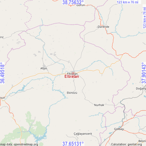
Elbistan GPS coordinates[2]
38° 12' 21.276" North, 37° 11' 53.88" East
| Map corner | latitude | longitude |
|---|---|---|
| Upper-left | 38.75632°, | 36.49518° |
| Center: | 38.20591°, | 37.1983° |
| Lower-right: | 37.65131°, | 37.90143° |
| Map W x H: | 122.9×122.9 km | = 76.4×76.4mi |
| max Lat: | 42.02683° ⇑58% North |
| Elbistan: | 38.20591° |
| min Lat: | ⇓42% South 35.9025° |
| min Long | Elbistan | max Long |
| 25.90902° | 37.1983° | 44.60099° |
| W 57.5%⇐ | ⇒42.5% E |
Elevation
Elevation of Elbistan is 1139 m = 3737 ft, and this is 421.6 m = 1383 ft above average elevation for this country.
| Max E: |
2682 m = 8799 ft | 22.9% |
| Elbistan | 1139 m 3737 ft | |
| Avg. | 717.4 m = 2354 ft | |
Min E: |
0 m = 0 ft | 77.1% |
See also: Elbistan elevation on elevation.city.
Geographical zone
Elbistan is located in North temperate zone (between Tropic of Cancer and the Arctic Circle). Distance of this Northern Tropic circle is 1642.2 km =1020.4 mi to South.| Distance of | km | miles | from Elbistan |
|---|---|---|---|
| North Pole | 5759 | 3578.5 | to North |
| Arctic Circle | 3153.1 | 1959.2 | to North |
| Tropic Cancer | 1642.2 | 1020.4 | to South |
| Equator | 4248.1 | 2639.6 | to South |


Nearby cities:
15 places around Elbistan: (largest is in red/bold)
• Afşin
25.3 km =15.7 mi,  280°
280°
• Ağabeyli
53 km =32.9 mi,  187°
187°
• Balaban
43.7 km =27.2 mi,  49°
49°
• Celeyke
16.3 km =10.1 mi,  183°
183°
• Darende
46.3 km =28.8 mi,  35°
35°
• Doğanşehir
60.3 km =37.5 mi,  102°
102°
• Gölbaşı
60.7 km =37.7 mi,  140°
140°
• Gücük
24.8 km =15.4 mi,  93°
93°
• Gürün
57.8 km =35.9 mi,  6°
6°
• Kürecik
49.6 km =30.8 mi,  72°
72°
• Nurhak
34.3 km =21.3 mi, 141°
• Süleymanlı
49.9 km =31 mi,  222°
222°
• Tanır
34.4 km =21.4 mi,  313°
313°
• Çardak
35.1 km =21.8 mi,  248°
248°
• Çağlayancerit
51.8 km =32.2 mi,  171°
171°
Sources, notices
• [Note1] Compared only with cities in Turkey existing in our database
• [Src1] Map data: © OpenStreetMap contributors (CC-BY-SA)
• [Src2] Other city data from geonames.org with taken over terms of usage.
• [Src3] Geographical zone / Annual Mean Temperature by Robert A. Rohde @ Wikipedia
