Başyayla geodata
Başyayla (Karaman) is a seat of a second-order administrative division; located in Turkey in Europe/Istanbul (GMT+3) time zone. With population of 5,713 people, there are 673 cities with bigger population in this country. Compared to other cities in Turkey, 94.1% of cities are located further ↑North; 63.6% of cities are located further →East and 85.7% of cities have lower elevation than Başyayla. Note1


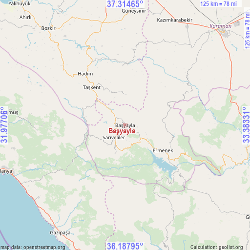
Başyayla GPS coordinates[2]
36° 45' 12.132" North, 32° 40' 48.648" East
| Map corner | latitude | longitude |
|---|---|---|
| Upper-left | 37.31465°, | 31.97706° |
| Center: | 36.75337°, | 32.68018° |
| Lower-right: | 36.18795°, | 33.38331° |
| Map W x H: | 125.3×125.3 km | = 77.9×77.9mi |
| max Lat: | 42.02683° ⇑94.1% North |
| Başyayla: | 36.75337° |
| min Lat: | ⇓5.9% South 35.9025° |
| min Long | Başyayla | max Long |
| 25.90902° | 32.68018° | 44.60099° |
| W 36.4%⇐ | ⇒63.6% E |
Elevation
Elevation of Başyayla is 1327 m = 4354 ft, and this is 609.6 m = 2000 ft above average elevation for this country.
| Max E: |
2682 m = 8799 ft | 14.3% |
| Başyayla | 1327 m 4354 ft | |
| Avg. | 717.4 m = 2354 ft | |
Min E: |
0 m = 0 ft | 85.7% |
See also: Turkey elevation on elevation.city.
Geographical zone
Başyayla is located in North temperate zone (between Tropic of Cancer and the Arctic Circle). Distance of this Northern Tropic circle is 1480.7 km =920.1 mi to South.| Distance of | km | miles | from Başyayla |
|---|---|---|---|
| North Pole | 5920.5 | 3678.8 | to North |
| Arctic Circle | 3314.6 | 2059.6 | to North |
| Tropic Cancer | 1480.7 | 920.1 | to South |
| Equator | 4086.6 | 2539.3 | to South |


Nearby cities:
15 places around Başyayla: (largest is in red/bold)
• Belören
52.5 km =32.6 mi,  347°
347°
• Bucakkışla
37.7 km =23.4 mi,  53°
53°
• Demirtaş
56.7 km =35.2 mi,  230°
230°
• Ermenek
22.7 km =14.1 mi,  123°
123°
• Göktepe
15 km =9.3 mi,  199°
199°
• Güneysınır
57.5 km =35.7 mi,  4°
4°
• Hadim
32.8 km =20.4 mi,  322°
322°
• Kazancı
32.3 km =20.1 mi,  149°
149°
• Kazımkarabekir
58.5 km =36.4 mi,  25°
25°
• Köprülü
44.2 km =27.5 mi,  266°
266°
• Mahmutlar
59.9 km =37.2 mi,  241°
241°
• Sarıveliler
8.7 km =5.4 mi,  224°
224°
• Taşkent
25.4 km =15.8 mi, 318°
• Tepebaşı
10.4 km =6.5 mi,  158°
158°
• Üçpınar
56.4 km =35 mi, 318°
Sources, notices
• [Note1] Compared only with cities in Turkey existing in our database
• [Src1] Map data: © OpenStreetMap contributors (CC-BY-SA)
• [Src2] Other city data from geonames.org with taken over terms of usage.
• [Src3] Geographical zone / Annual Mean Temperature by Robert A. Rohde @ Wikipedia
