Dikmen geodata
Dikmen (Sinop) is a seat of a second-order administrative division; located in Turkey in Europe/Istanbul (GMT+3) time zone. In our database, there are 1323 cities with bigger population. Compared to other cities in Turkey, 98.5% of cities are located further ↓South; 53.2% of cities are located further →East and 74.8% of cities have higher elevation than Dikmen. Note1


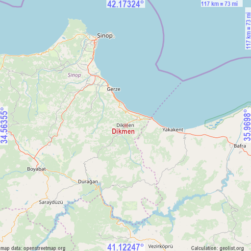
Dikmen GPS coordinates[2]
41° 39' 0" North, 35° 16' 0.012" East
| Map corner | latitude | longitude |
|---|---|---|
| Upper-left | 42.17324°, | 34.56355° |
| Center: | 41.65°, | 35.26667° |
| Lower-right: | 41.12247°, | 35.9698° |
| Map W x H: | 116.8×116.8 km | = 72.6×72.6mi |
| max Lat: | 42.02683° ⇑1.5% North |
| Dikmen: | 41.65° |
| min Lat: | ⇓98.5% South 35.9025° |
| min Long | Dikmen | max Long |
| 25.90902° | 35.26667° | 44.60099° |
| W 46.8%⇐ | ⇒53.2% E |
Elevation
Elevation of Dikmen is 178 m = 584 ft, and this is 539.4 m = 1770 ft below average elevation for this country.
| Max E: |
2682 m = 8799 ft | 74.8% |
| Avg. | 717.4 m = 2354 ft | |
| Dikmen | 178 m = 584 ft | |
Min E: |
0 m = 0 ft | 25.2% |
See also: Turkey elevation on elevation.city.
Geographical zone
Dikmen is located in North temperate zone (between Tropic of Cancer and the Arctic Circle). Distance of this Northern Tropic circle is 2025.1 km =1258.3 mi to South.| Distance of | km | miles | from Dikmen |
|---|---|---|---|
| North Pole | 5376 | 3340.5 | to North |
| Arctic Circle | 2770.1 | 1721.3 | to North |
| Tropic Cancer | 2025.1 | 1258.3 | to South |
| Equator | 4631 | 2877.6 | to South |


Nearby cities:
15 places around Dikmen: (largest is in red/bold)
• Alaçam
28 km =17.4 mi,  100°
100°
• Bafra
54 km =33.6 mi, 99°
• Beşpınar
57.1 km =35.5 mi,  184°
184°
• Boyabat
46.2 km =28.7 mi,  244°
244°
• Boğazkaya
54.7 km =34 mi,  114°
114°
• Durağan
31.5 km =19.6 mi,  214°
214°
• Erfelek
38.5 km =23.9 mi,  311°
311°
• Gerze
17.9 km =11.1 mi,  342°
342°
• Kabalı
28.1 km =17.5 mi,  322°
322°
• Kolay
51.4 km =31.9 mi,  120°
120°
• Mezraa
51.8 km =32.2 mi,  193°
193°
• Saraydüzü
50 km =31.1 mi,  224°
224°
• Sinop
42.8 km =26.6 mi,  348°
348°
• Yakakent
21.9 km =13.6 mi, 95°
• Çerçiler
28.5 km =17.7 mi, 185°
Sources, notices
• [Note1] Compared only with cities in Turkey existing in our database
• [Src1] Map data: © OpenStreetMap contributors (CC-BY-SA)
• [Src2] Other city data from geonames.org with taken over terms of usage.
• [Src3] Geographical zone / Annual Mean Temperature by Robert A. Rohde @ Wikipedia
