Ushirombo geodata
Ushirombo (Geita) is a populated place; located in Tanzania in Africa/Dar_es_Salaam (GMT+3) time zone. With population of 95,052 people, there are 17 cities with bigger population in this country. Compared to other cities in Tanzania, 76.9% of cities are located further ↓South; 87.1% of cities are located further →East and 60.1% of cities have lower elevation than Ushirombo. Note1


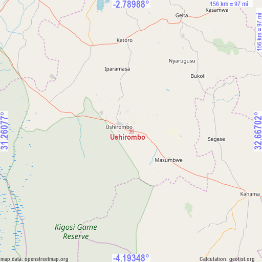
Ushirombo GPS coordinates[2]
3° 29' 30.984" South, 31° 57' 50.004" East
| Map corner | latitude | longitude |
|---|---|---|
| Upper-left | -2.78988°, | 31.26077° |
| Center: | -3.49194°, | 31.96389° |
| Lower-right: | -4.19348°, | 32.66702° |
| Map W x H: | 156.1×156.1 km | = 97×97mi |
| max Lat: | -1.14389° ⇑23.1% North |
| Ushirombo: | -3.49194° |
| min Lat: | ⇓76.9% South -11.36667° |
| min Long | Ushirombo | max Long |
| 29.62667° | 31.96389° | 40.33333° |
| W 12.9%⇐ | ⇒87.1% E |
Elevation
Elevation of Ushirombo is 1186 m = 3891 ft, and this is 243.2 m = 798 ft above average elevation for this country.
| Max E: |
2377 m = 7799 ft | 39.9% |
| Ushirombo | 1186 m 3891 ft | |
| Avg. | 942.8 m = 3093 ft | |
Min E: |
0 m = 0 ft | 60.1% |
See also: Ushirombo elevation on elevation.city.
Geographical zone
Ushirombo is located in South Torrid zone (between Equator and Tropic of Capricorn). Distance of Equator is 388.3 km =241.3 mi to North.| Distance of | km | miles | from Ushirombo |
|---|---|---|---|
| Equator | 388.3 | 241.3 | to North |
| Tropic Capricorn | 2217.7 | 1378 | to South |
| Antarctic Circle | 7012.9 | 4357.6 | to South |
| South Pole | 9618.8 | 5976.8 | to South |


Nearby cities:
15 places around Ushirombo: (largest is in red/bold)
• Biharamulo
120.1 km =74.6 mi,  322°
322°
• Bukene
131.1 km =81.5 mi,  128°
128°
• Buseresere
53 km =32.9 mi,  349°
349°
• Chato
97.5 km =60.6 mi, 347°
• Geita
75.1 km =46.7 mi,  23°
23°
• Isaka
116.7 km =72.5 mi,  112°
112°
• Kahama
80.1 km =49.8 mi,  118°
118°
• Kakonko
113.4 km =70.5 mi,  281°
281°
• Kasamwa
88.4 km =54.9 mi,  36°
36°
• Katoro
53 km =32.9 mi, 351°
• Kibondo
138.4 km =86 mi,  265°
265°
• Masumbwe
29 km =18 mi, 122°
• Mhango
101.1 km =62.8 mi,  76°
76°
• Misasi
135.8 km =84.4 mi,  66°
66°
• Uyovu
53.9 km =33.5 mi,  295°
295°
Sources, notices
• [Note1] Compared only with cities in Tanzania existing in our database
• [Src1] Map data: © OpenStreetMap contributors (CC-BY-SA)
• [Src2] Other city data from geonames.org with taken over terms of usage.
• [Src3] Geographical zone / Annual Mean Temperature by Robert A. Rohde @ Wikipedia
