Biharamulo geodata
Biharamulo (Kagera) is a populated place; located in Tanzania in Africa/Dar_es_Salaam (GMT+3) time zone. With population of 34,038 people, there are 51 cities with bigger population in this country. Compared to other cities in Tanzania, 89.5% of cities are located further ↓South; 92.7% of cities are located further →East and 81.8% of cities have lower elevation than Biharamulo. Note1


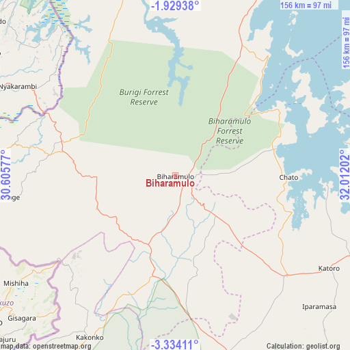
Biharamulo GPS coordinates[2]
2° 37' 54.984" South, 31° 18' 32.004" East
| Map corner | latitude | longitude |
|---|---|---|
| Upper-left | -1.92938°, | 30.60577° |
| Center: | -2.63194°, | 31.30889° |
| Lower-right: | -3.33411°, | 32.01202° |
| Map W x H: | 156.2×156.2 km | = 97.1×97.1mi |
| max Lat: | -1.14389° ⇑10.5% North |
| Biharamulo: | -2.63194° |
| min Lat: | ⇓89.5% South -11.36667° |
| min Long | Biharamulo | max Long |
| 29.62667° | 31.30889° | 40.33333° |
| W 7.3%⇐ | ⇒92.7% E |
Elevation
Elevation of Biharamulo is 1479 m = 4852 ft, and this is 536.2 m = 1759 ft above average elevation for this country.
| Max E: |
2377 m = 7799 ft | 18.2% |
| Biharamulo | 1479 m 4852 ft | |
| Avg. | 942.8 m = 3093 ft | |
Min E: |
0 m = 0 ft | 81.8% |
See also: Tanzania elevation on elevation.city.
Geographical zone
Biharamulo is located in South Torrid zone (between Equator and Tropic of Capricorn). Distance of Equator is 292.6 km =181.8 mi to North.| Distance of | km | miles | from Biharamulo |
|---|---|---|---|
| Equator | 292.6 | 181.8 | to North |
| Tropic Capricorn | 2313.3 | 1437.4 | to South |
| Antarctic Circle | 7108.5 | 4417 | to South |
| South Pole | 9714.4 | 6036.2 | to South |


Nearby cities:
15 places around Biharamulo: (largest is in red/bold)
• Bugarama
90.7 km =56.4 mi,  252°
252°
• Bugene
117.2 km =72.8 mi,  350°
350°
• Buseresere
76.5 km =47.5 mi,  124°
124°
• Chato
50.9 km =31.6 mi,  90°
90°
• Geita
106 km =65.9 mi,  104°
104°
• Kabanga
93.4 km =58 mi,  269°
269°
• Kakonko
81.9 km =50.9 mi,  207°
207°
• Kamachumu
117.9 km =73.3 mi,  17°
17°
• Katoro
78.2 km =48.6 mi, 123°
• Muleba
96.1 km =59.7 mi, 23°
• Ngara
73.8 km =45.9 mi,  280°
280°
• Nshamba
96.5 km =60 mi, 16°
• Nyakahanga
115.9 km =72 mi, 350°
• Rulenge
75.7 km =47 mi,  262°
262°
• Uyovu
76.3 km =47.4 mi,  161°
161°
Sources, notices
• [Note1] Compared only with cities in Tanzania existing in our database
• [Src1] Map data: © OpenStreetMap contributors (CC-BY-SA)
• [Src2] Other city data from geonames.org with taken over terms of usage.
• [Src3] Geographical zone / Annual Mean Temperature by Robert A. Rohde @ Wikipedia
