Bukene geodata
Bukene (Tabora) is a populated place; located in Tanzania in Africa/Dar_es_Salaam (GMT+3) time zone. With population of 7,444 people, there are 260 cities with bigger population in this country. Compared to other cities in Tanzania, 66.8% of cities are located further ↓South; 81.8% of cities are located further →East and 62.6% of cities have lower elevation than Bukene. Note1


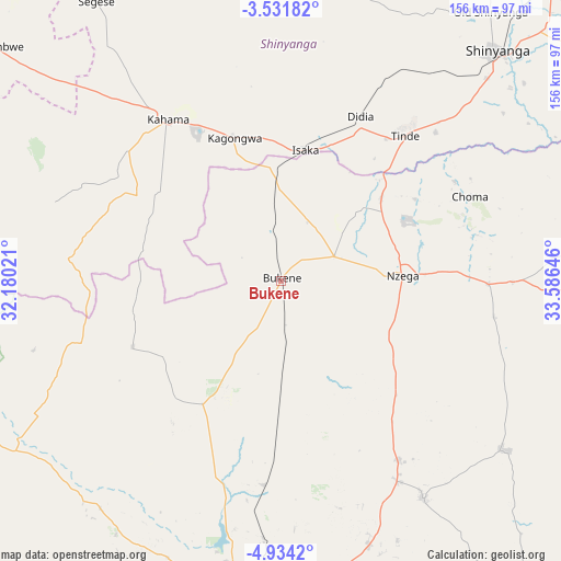
Bukene GPS coordinates[2]
4° 13' 59.988" South, 32° 52' 59.988" East
| Map corner | latitude | longitude |
|---|---|---|
| Upper-left | -3.53182°, | 32.18021° |
| Center: | -4.23333°, | 32.88333° |
| Lower-right: | -4.9342°, | 33.58646° |
| Map W x H: | 155.9×155.9 km | = 96.9×96.9mi |
| max Lat: | -1.14389° ⇑33.2% North |
| Bukene: | -4.23333° |
| min Lat: | ⇓66.8% South -11.36667° |
| min Long | Bukene | max Long |
| 29.62667° | 32.88333° | 40.33333° |
| W 18.2%⇐ | ⇒81.8% E |
Elevation
Elevation of Bukene is 1200 m = 3937 ft, and this is 257.2 m = 844 ft above average elevation for this country.
| Max E: |
2377 m = 7799 ft | 37.4% |
| Bukene | 1200 m 3937 ft | |
| Avg. | 942.8 m = 3093 ft | |
Min E: |
0 m = 0 ft | 62.6% |
See also: Tanzania elevation on elevation.city.
Geographical zone
Bukene is located in South Torrid zone (between Equator and Tropic of Capricorn). Distance of Equator is 470.7 km =292.5 mi to North.| Distance of | km | miles | from Bukene |
|---|---|---|---|
| Equator | 470.7 | 292.5 | to North |
| Tropic Capricorn | 2135.2 | 1326.8 | to South |
| Antarctic Circle | 6930.5 | 4306.4 | to South |
| South Pole | 9536.4 | 5925.6 | to South |


Nearby cities:
15 places around Bukene: (largest is in red/bold)
• Igunga
111 km =69 mi,  92°
92°
• Igurubi
94.2 km =58.5 mi,  74°
74°
• Isaka
37.5 km =23.3 mi,  8°
8°
• Kahama
54.5 km =33.9 mi,  324°
324°
• Mabama
107.3 km =66.7 mi,  201°
201°
• Masumbwe
102.4 km =63.6 mi,  310°
310°
• Mhango
105.7 km =65.7 mi,  357°
357°
• Mwadui
110 km =68.4 mi,  46°
46°
• Nzega
33.3 km =20.7 mi, 86°
• Old Shinyanga
95.2 km =59.2 mi,  37°
37°
• Shinyanga
87 km =54.1 mi, 43°
• Songwa
106.2 km =66 mi, 41°
• Tabora
87.3 km =54.2 mi,  184°
184°
• Tinde
52.4 km =32.6 mi, 42°
• Tumbi
94.1 km =58.5 mi,  190°
190°
Sources, notices
• [Note1] Compared only with cities in Tanzania existing in our database
• [Src1] Map data: © OpenStreetMap contributors (CC-BY-SA)
• [Src2] Other city data from geonames.org with taken over terms of usage.
• [Src3] Geographical zone / Annual Mean Temperature by Robert A. Rohde @ Wikipedia
