Kadubivtsi geodata
Kadubivtsi (Chernivtsi Oblast') is a populated place; located in Ukraine in Europe/Kiev (GMT+3) time zone. With population of 3,161 people, there are 896 cities with bigger population in this country. Compared to other cities in Ukraine, 57.5% of cities are located further ↓South; 81.9% of cities are located further →East and 83.2% of cities have lower elevation than Kadubivtsi. Note1


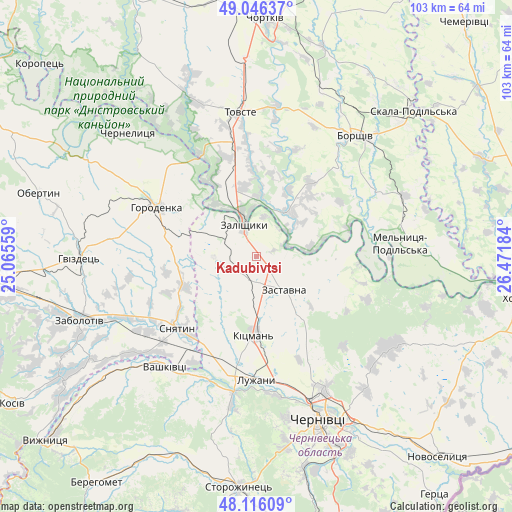
Kadubivtsi GPS coordinates[2]
48° 35' 0.132" North, 25° 46' 7.356" East
| Map corner | latitude | longitude |
|---|---|---|
| Upper-left | 49.04637°, | 25.06559° |
| Center: | 48.58337°, | 25.76871° |
| Lower-right: | 48.11609°, | 26.47184° |
| Map W x H: | 103.4×103.4 km | = 64.2×64.2mi |
| max Lat: | 52.18903° ⇑42.5% North |
| Kadubivtsi: | 48.58337° |
| min Lat: | ⇓57.5% South 44.39214° |
| min Long | Kadubivtsi | max Long |
| 22.20555° | 25.76871° | 40.13222° |
| W 18.1%⇐ | ⇒81.9% E |
Elevation
Elevation of Kadubivtsi is 264 m = 866 ft, and this is 108.2 m = 355 ft above average elevation for this country.
| Max E: |
886 m = 2907 ft | 16.8% |
| Kadubivtsi | 264 m 866 ft | |
| Avg. | 155.8 m = 511 ft | |
Min E: |
-3 m = -10 ft | 83.2% |
See also: Ukraine elevation on elevation.city.
Geographical zone
Kadubivtsi is located in North temperate zone (between Tropic of Cancer and the Arctic Circle). Distance of this North polar circle is 1999.2 km =1242.2 mi to North.| Distance of | km | miles | from Kadubivtsi |
|---|---|---|---|
| North Pole | 4605.1 | 2861.5 | to North |
| Arctic Circle | 1999.2 | 1242.2 | to North |
| Tropic Cancer | 2796 | 1737.4 | to South |
| Equator | 5402 | 3356.6 | to South |


Nearby cities:
15 places around Kadubivtsi: (largest is in red/bold)
• Borshchiv
31.7 km =19.7 mi,  39°
39°
• Chernyatyn
25.1 km =15.6 mi,  289°
289°
• Horodenka
22 km =13.7 mi,  296°
296°
• Kitsman’
15.5 km =9.6 mi,  180°
180°
• Kostryzhivka
8.9 km =5.5 mi,  332°
332°
• Luzhany
24.3 km =15.1 mi, 179°
• Nyrkiv
28.6 km =17.8 mi, 334°
• Shypyntsi
23 km =14.3 mi, 184°
• Sniatyn
21.1 km =13.1 mi,  224°
224°
• Stetseva
15.5 km =9.6 mi,  246°
246°
• Tovste
29.4 km =18.3 mi,  353°
353°
• Vashkivtsi
29.2 km =18.1 mi, 220°
• Verenchanka
4.4 km =2.7 mi,  202°
202°
• Zalishchyky
7 km =4.3 mi,  341°
341°
• Zastavna
8.7 km =5.4 mi,  140°
140°
Sources, notices
• [Note1] Compared only with cities in Ukraine existing in our database
• [Src1] Map data: © OpenStreetMap contributors (CC-BY-SA)
• [Src2] Other city data from geonames.org with taken over terms of usage.
• [Src3] Geographical zone / Annual Mean Temperature by Robert A. Rohde @ Wikipedia
