Sloboda geodata
Sloboda (Sumy) is a populated place; located in Ukraine in Europe/Kiev (GMT+3) time zone. With population of 2,949 people, there are 959 cities with bigger population in this country. Compared to other cities in Ukraine, 96.6% of cities are located further ↓South; 53.3% of cities are located further ←West and 55.5% of cities have lower elevation than Sloboda. Note1


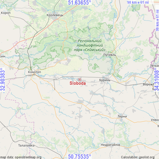
Sloboda GPS coordinates[2]
51° 11' 53.016" North, 33° 36' 25.02" East
| Map corner | latitude | longitude |
|---|---|---|
| Upper-left | 51.63655°, | 32.90383° |
| Center: | 51.19806°, | 33.60695° |
| Lower-right: | 50.75535°, | 34.31008° |
| Map W x H: | 98×98 km | = 60.9×60.9mi |
| max Lat: | 52.18903° ⇑3.4% North |
| Sloboda: | 51.19806° |
| min Lat: | ⇓96.6% South 44.39214° |
| min Long | Sloboda | max Long |
| 22.20555° | 33.60695° | 40.13222° |
| W 53.3%⇐ | ⇒46.7% E |
Elevation
Elevation of Sloboda is 154 m = 505 ft, and this is 1.8 m = 6 ft below average elevation for this country.
| Max E: |
886 m = 2907 ft | 44.5% |
| Avg. | 155.8 m = 511 ft | |
| Sloboda | 154 m = 505 ft | |
Min E: |
-3 m = -10 ft | 55.5% |
See also: Ukraine elevation on elevation.city.
Geographical zone
Sloboda is located in North temperate zone (between Tropic of Cancer and the Arctic Circle). Distance of this North polar circle is 1708.5 km =1061.6 mi to North.| Distance of | km | miles | from Sloboda |
|---|---|---|---|
| North Pole | 4314.4 | 2680.8 | to North |
| Arctic Circle | 1708.5 | 1061.6 | to North |
| Tropic Cancer | 3086.8 | 1918 | to South |
| Equator | 5692.7 | 3537.3 | to South |


Nearby cities:
15 places around Sloboda: (largest is in red/bold)
• Bakhmach
53.9 km =33.5 mi,  268°
268°
• Bakhmach
58 km =36 mi, 270°
• Baturyn
53.3 km =33.1 mi,  287°
287°
• Bilopillya
49.5 km =30.8 mi,  96°
96°
• Buryn’
15.9 km =9.9 mi,  89°
89°
• Hlukhiv
57.5 km =35.7 mi,  21°
21°
• Konotop
28.5 km =17.7 mi,  279°
279°
• Krolevets’
41.8 km =26 mi,  338°
338°
• Nedryhayliv
44.7 km =27.8 mi,  155°
155°
• Putyvl’
24 km =14.9 mi,  49°
49°
• Romny
50.6 km =31.4 mi,  190°
190°
• Shalyhyne
54.8 km =34.1 mi,  40°
40°
• Talalayivka
51.4 km =31.9 mi,  219°
219°
• Terny
34.4 km =21.4 mi,  132°
132°
• Vorozhba
42.8 km =26.6 mi, 93°
Sources, notices
• [Note1] Compared only with cities in Ukraine existing in our database
• [Src1] Map data: © OpenStreetMap contributors (CC-BY-SA)
• [Src2] Other city data from geonames.org with taken over terms of usage.
• [Src3] Geographical zone / Annual Mean Temperature by Robert A. Rohde @ Wikipedia
