Buryn’ geodata
Buryn’ (Sumy) is a seat of a second-order administrative division; located in Ukraine in Europe/Kiev (GMT+3) time zone. With population of 11,400 people, there are 321 cities with bigger population in this country. Compared to other cities in Ukraine, 96.7% of cities are located further ↓South; 58.8% of cities are located further ←West and 54% of cities have lower elevation than Buryn’. Note1


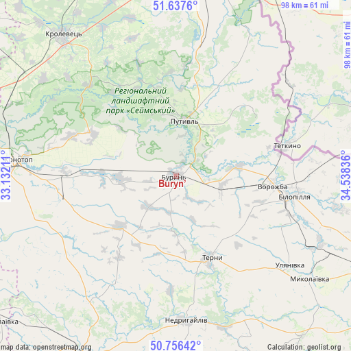
Buryn’ GPS coordinates[2]
51° 11' 56.832" North, 33° 50' 6.828" East
| Map corner | latitude | longitude |
|---|---|---|
| Upper-left | 51.6376°, | 33.13211° |
| Center: | 51.19912°, | 33.83523° |
| Lower-right: | 50.75642°, | 34.53836° |
| Map W x H: | 98×98 km | = 60.9×60.9mi |
| max Lat: | 52.18903° ⇑3.3% North |
| Buryn’: | 51.19912° |
| min Lat: | ⇓96.7% South 44.39214° |
| min Long | Buryn’ | max Long |
| 22.20555° | 33.83523° | 40.13222° |
| W 58.8%⇐ | ⇒41.2% E |
Elevation
Elevation of Buryn’ is 150 m = 492 ft, and this is 5.8 m = 19 ft below average elevation for this country.
| Max E: |
886 m = 2907 ft | 46% |
| Avg. | 155.8 m = 511 ft | |
| Buryn’ | 150 m = 492 ft | |
Min E: |
-3 m = -10 ft | 54% |
See also: Ukraine elevation on elevation.city.
Geographical zone
Buryn’ is located in North temperate zone (between Tropic of Cancer and the Arctic Circle). Distance of this North polar circle is 1708.4 km =1061.6 mi to North.| Distance of | km | miles | from Buryn’ |
|---|---|---|---|
| North Pole | 4314.3 | 2680.8 | to North |
| Arctic Circle | 1708.4 | 1061.6 | to North |
| Tropic Cancer | 3086.9 | 1918.1 | to South |
| Equator | 5692.8 | 3537.3 | to South |


Nearby cities:
15 places around Buryn’: (largest is in red/bold)
• Bakhmach
69.8 km =43.4 mi,  268°
268°
• Baturyn
68.6 km =42.6 mi,  283°
283°
• Bilopillya
33.7 km =20.9 mi,  99°
99°
• Hlukhiv
53.6 km =33.3 mi,  6°
6°
• Konotop
44.3 km =27.5 mi, 275°
• Krolevets’
49.8 km =30.9 mi,  321°
321°
• Nedryhayliv
40.7 km =25.3 mi,  175°
175°
• Putyvl’
15.6 km =9.7 mi, 9°
• Romny
55.9 km =34.7 mi,  206°
206°
• Shalyhyne
45.9 km =28.5 mi,  25°
25°
• Sloboda
15.9 km =9.9 mi, 269°
• Talalayivka
62.8 km =39 mi,  230°
230°
• Terny
25.2 km =15.7 mi,  157°
157°
• Vorozhba
26.9 km =16.7 mi, 96°
• Yesman’
65.5 km =40.7 mi, 14°
Sources, notices
• [Note1] Compared only with cities in Ukraine existing in our database
• [Src1] Map data: © OpenStreetMap contributors (CC-BY-SA)
• [Src2] Other city data from geonames.org with taken over terms of usage.
• [Src3] Geographical zone / Annual Mean Temperature by Robert A. Rohde @ Wikipedia
