Krolevets’ geodata
Krolevets’ (Sumy) is a seat of a second-order administrative division; located in Ukraine in Europe/Kiev (GMT+3) time zone. With population of 24,115 people, there are 171 cities with bigger population in this country. Compared to other cities in Ukraine, 98.3% of cities are located further ↓South; 50.7% of cities are located further ←West and 59.2% of cities have lower elevation than Krolevets’. Note1


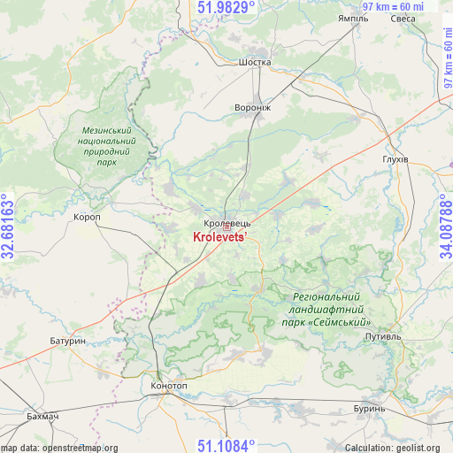
Krolevets’ GPS coordinates[2]
51° 32' 51.9" North, 33° 23' 5.1" East
| Map corner | latitude | longitude |
|---|---|---|
| Upper-left | 51.9829°, | 32.68163° |
| Center: | 51.54775°, | 33.38475° |
| Lower-right: | 51.1084°, | 34.08788° |
| Map W x H: | 97.2×97.2 km | = 60.4×60.4mi |
| max Lat: | 52.18903° ⇑1.7% North |
| Krolevets’: | 51.54775° |
| min Lat: | ⇓98.3% South 44.39214° |
| min Long | Krolevets’ | max Long |
| 22.20555° | 33.38475° | 40.13222° |
| W 50.7%⇐ | ⇒49.3% E |
Elevation
Elevation of Krolevets’ is 166 m = 545 ft, and this is 10.2 m = 33 ft above average elevation for this country.
| Max E: |
886 m = 2907 ft | 40.8% |
| Krolevets’ | 166 m 545 ft | |
| Avg. | 155.8 m = 511 ft | |
Min E: |
-3 m = -10 ft | 59.2% |
See also: Ukraine elevation on elevation.city.
Geographical zone
Krolevets’ is located in North temperate zone (between Tropic of Cancer and the Arctic Circle). Distance of this North polar circle is 1669.6 km =1037.4 mi to North.| Distance of | km | miles | from Krolevets’ |
|---|---|---|---|
| North Pole | 4275.5 | 2656.7 | to North |
| Arctic Circle | 1669.6 | 1037.4 | to North |
| Tropic Cancer | 3125.7 | 1942.2 | to South |
| Equator | 5731.6 | 3561.5 | to South |


Nearby cities:
15 places around Krolevets’: (largest is in red/bold)
• Avdiyivka
47.7 km =29.6 mi,  302°
302°
• Bakhmach
55.8 km =34.7 mi,  223°
223°
• Bakhmach
57.3 km =35.6 mi,  227°
227°
• Baturyn
41.7 km =25.9 mi,  237°
237°
• Buryn’
49.8 km =30.9 mi,  141°
141°
• Hlukhiv
39.5 km =24.5 mi,  68°
68°
• Konotop
36.4 km =22.6 mi,  200°
200°
• Korop
29.5 km =18.3 mi,  274°
274°
• Novhorod-Sivers’kyy
51.6 km =32.1 mi,  350°
350°
• Putyvl’
41 km =25.5 mi,  124°
124°
• Shalyhyne
51 km =31.7 mi,  87°
87°
• Shostka
35.5 km =22.1 mi,  9°
9°
• Sloboda
41.8 km =26 mi,  158°
158°
• Yampil’
52.4 km =32.6 mi,  31°
31°
• Yesman’
53.2 km =33.1 mi,  62°
62°
Sources, notices
• [Note1] Compared only with cities in Ukraine existing in our database
• [Src1] Map data: © OpenStreetMap contributors (CC-BY-SA)
• [Src2] Other city data from geonames.org with taken over terms of usage.
• [Src3] Geographical zone / Annual Mean Temperature by Robert A. Rohde @ Wikipedia
