Pyryatyn geodata
Pyryatyn (Poltava) is a seat of a second-order administrative division; located in Ukraine in Europe/Kiev (GMT+3) time zone. With population of 16,089 people, there are 243 cities with bigger population in this country. Compared to other cities in Ukraine, 87.2% of cities are located further ↓South; 55.4% of cities are located further →East and 55.4% of cities have higher elevation than Pyryatyn. Note1


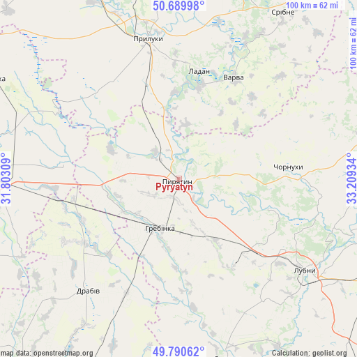
Pyryatyn GPS coordinates[2]
50° 14' 32.712" North, 32° 30' 22.356" East
| Map corner | latitude | longitude |
|---|---|---|
| Upper-left | 50.68998°, | 31.80309° |
| Center: | 50.24242°, | 32.50621° |
| Lower-right: | 49.79062°, | 33.20934° |
| Map W x H: | 100×100 km | = 62.1×62.1mi |
| max Lat: | 52.18903° ⇑12.8% North |
| Pyryatyn: | 50.24242° |
| min Lat: | ⇓87.2% South 44.39214° |
| min Long | Pyryatyn | max Long |
| 22.20555° | 32.50621° | 40.13222° |
| W 44.6%⇐ | ⇒55.4% E |
Elevation
Elevation of Pyryatyn is 119 m = 390 ft, and this is 36.8 m = 121 ft below average elevation for this country.
| Max E: |
886 m = 2907 ft | 55.4% |
| Avg. | 155.8 m = 511 ft | |
| Pyryatyn | 119 m = 390 ft | |
Min E: |
-3 m = -10 ft | 44.6% |
See also: Ukraine elevation on elevation.city.
Geographical zone
Pyryatyn is located in North temperate zone (between Tropic of Cancer and the Arctic Circle). Distance of this North polar circle is 1814.7 km =1127.6 mi to North.| Distance of | km | miles | from Pyryatyn |
|---|---|---|---|
| North Pole | 4420.6 | 2746.8 | to North |
| Arctic Circle | 1814.7 | 1127.6 | to North |
| Tropic Cancer | 2980.5 | 1852 | to South |
| Equator | 5586.4 | 3471.2 | to South |


Nearby cities:
15 places around Pyryatyn: (largest is in red/bold)
• Bogdanivka
35.1 km =21.8 mi,  265°
265°
• Chernyakhivka
41 km =25.5 mi, 266°
• Chervone
41.7 km =25.9 mi,  287°
287°
• Chornukhy
31.1 km =19.3 mi,  84°
84°
• Dihtyari
42.2 km =26.2 mi,  26°
26°
• Drabiv
40.8 km =25.4 mi,  219°
219°
• Hrebinka
14.8 km =9.2 mi,  199°
199°
• Ladan
31.3 km =19.4 mi,  9°
9°
• Lisovi Sorochyntsi
51.2 km =31.8 mi,  345°
345°
• Lozovyy Yar
37.3 km =23.2 mi,  283°
283°
• Lubny
43.1 km =26.8 mi,  125°
125°
• Orzhytsya
52.2 km =32.4 mi,  164°
164°
• Pryluky
39.9 km =24.8 mi, 347°
• Varva
31.9 km =19.8 mi, 28°
• Zhuravka
27.3 km =17 mi, 13°
Sources, notices
• [Note1] Compared only with cities in Ukraine existing in our database
• [Src1] Map data: © OpenStreetMap contributors (CC-BY-SA)
• [Src2] Other city data from geonames.org with taken over terms of usage.
• [Src3] Geographical zone / Annual Mean Temperature by Robert A. Rohde @ Wikipedia
